← Previous Photo
B Street in Sparks
Next Photo →
Second Street, Reno

Truckee Meadows Map 1921

Date of photo: 1921
Photographer: Unknown

Source: Facebook: Old Reno

Tags: map, reno, sparks,

Available Sizes: 800x583 | 1024x747 | 2048x1494

Description

A map of Reno and Sparks in 1921. This map shows the landowners of most of the large parcels in the Truckee Meadows outside of the city limits.

Actions

⇓ Download This Photo

To download this photo, choose a size below, then right-click and select "Save As".

200x145 | 250x182 | 500x364 | 800x583 | 1024x747 | 2048x1494

⇓ Embed This Photo

To embed this photo in a blog or web page, choose a size below, then copy and paste the HTML or wiki code from the box.

200x145 | 250x182 | 500x364 | 800x583

HTML code

Wiki markup

Other Data

Date Uploaded: August 25, 2021

Permanent Link: http://wnhpc.com/details/fb2632653240360769

Contributor: Old Reno on Facebook

Source: Facebook: Old Reno

Source URL: https://www.facebook.com/OldReno/posts/2632654000360693

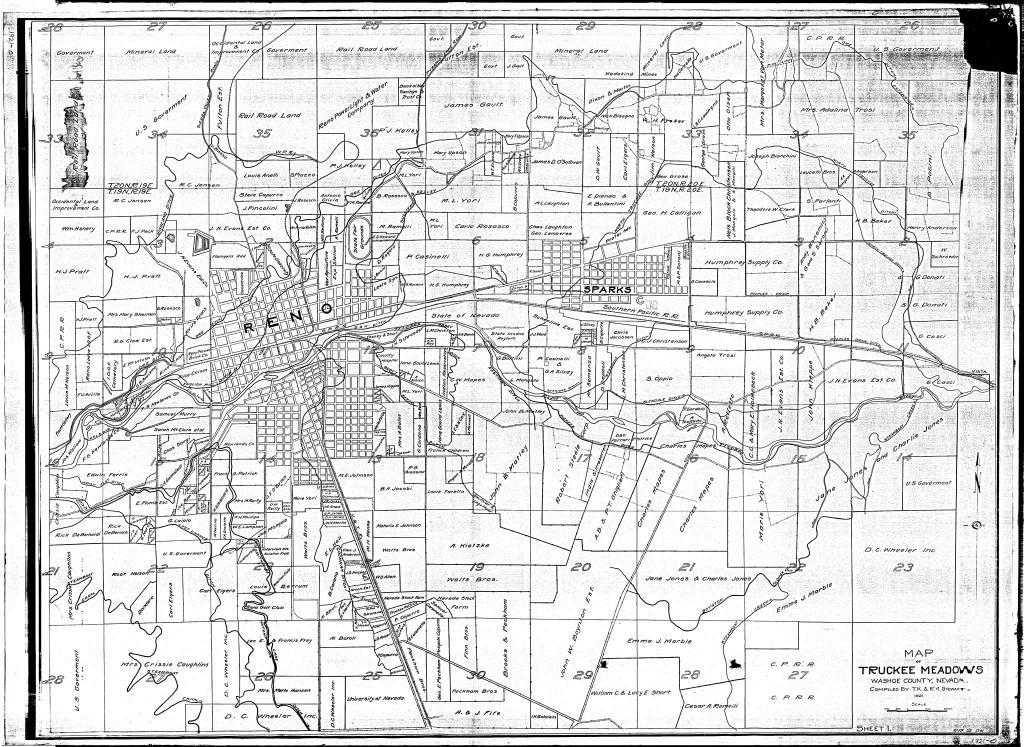
Source Caption: A 1921 map of Truckee Meadows lists land owners around Reno and Sparks a century ago.


Post A Comment