
← Previous Photo | Next Photo → |
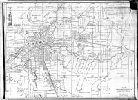
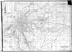
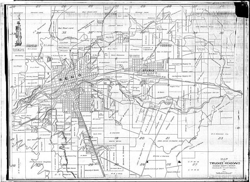
Truckee Meadows Map 1921
Date of photo: 1921
Photographer: Unknown
Source: Facebook: Old Reno

Description
A map of Reno and Sparks in 1921. This map shows the landowners of most of the large parcels in the Truckee Meadows outside of the city limits.
Actions
⇓ Download This Photo
⇓ Embed This Photo
Other Data
Date Uploaded: August 25, 2021
Permanent Link: http://wnhpc.com/details/fb2632653240360769
Contributor: Old Reno on Facebook
Source: Facebook: Old Reno
Source URL: https://www.facebook.com/OldReno/posts/2632654000360693
Source Caption: A 1921 map of Truckee Meadows lists land owners around Reno and Sparks a century ago.
Post A Comment