Available Sizes: 1024x751 | 2048x1502 | 4064x2982
Download: JPG (2289 KB)
Date Uploaded: May 22, 2024
Permanent Link: http://wnhpc.com/details/ym611xr3006
Source: Stanford Libraries
Source URL: https://exhibits.stanford.edu/mining/catalog/ym611xr3006
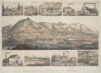
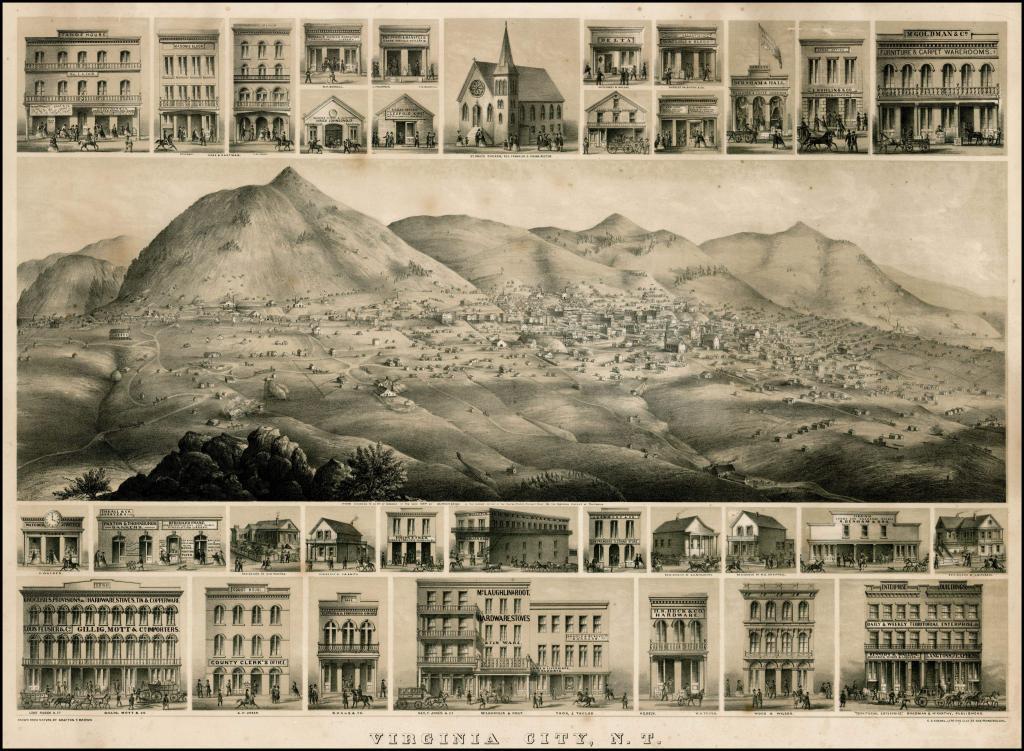
Source Caption: Fine example of Grafton Tyler Brown's rare birds-eye view of Virginia City, Nevada Territory, published by C. C. Kuchel in San Francisco, offered here in a variant edition that was apparently unknown to Reps. G.T. Brown's view of the Virginia City is one of the most sought after of all western birds-eye views. Published 3 years after Nevada became a territory and in the same year as Nevada obtained its statehood, the view depicts one of the most famous mining boom towns in the history of the American West. The view is G.T. Brown's second large format view of Virginia City, published 3 years after his smaller view of 1861, which is taken from a very different vantage point. There are two editions of this 1864 view, a view depicting 9 mills (complete with smokestacks) around the central town view, and the present edition, which includes smaller views of 15 buildings across the top and 18 buildings below the central town view, including the Newspaper Office where a young Mark Twain would have been working in 1864. As stated by John Reps in Views and Viewmakers of Urban America. . . , p. 166 (1984): Brown's second rendering of Virginia City is on of the most fascinating American city views. . . Brown surrounded his principal view of Nevada's most important silver mining town with thirty vivid vignettes showing details of various business structures. Perhaps the most interesting depicts the office of the Territorial Enterprise as it looked when the young Samuel Clemens [Mark Twain] first worked there as a cub reporter. . . . In addition to his training as an artist . . ., [Brown] made a living in Nevada, which he described in an advertisement for the Virginia City Mercantile Guide and Directory in 1864: "Traveling Artist in Nevada Territory, views of mills, mines, business houses, residences etc. drawn in the finest style." The following is excerpted from a catalog entry prepared by Holabird-Kagan Americana, which offered the "smokestack" edition of the view in a sale in November 2009 (cleaned and restored copy, which sold for $18,212): The central view in the middle of the lithograph is clearly looking roughly westward across the canyon at Virginia City and Mt. Davidson sketched from a point that may have later become the sight of the C&C shaft, which everyone today knows from the photo on the dust jacket cover of Stan Paher
Download Photo: JPG (2289 KB)
← Previous Photo
Next Photo →