Carson City Aerial 1977

Tags: aerial , carsoncity , jacksvalley , stewart

Date of photo: 1977

Photographer: Unknown

Source : Nevada Bureau of Mines and Geology, UNR

Available Sizes: 964x1024 | 1929x2048 | 6594x7000

Download: JPG (4408 KB)
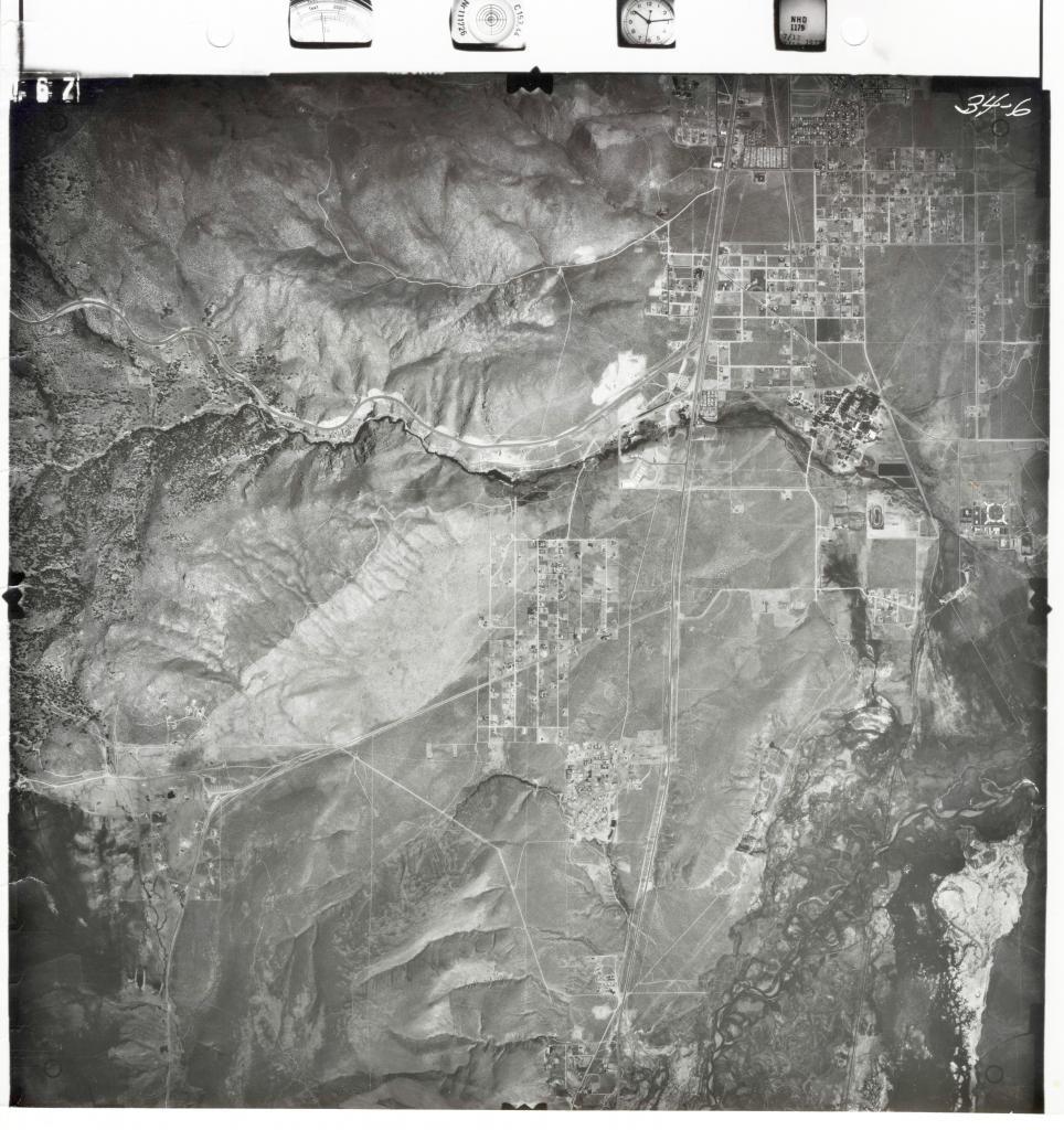
Historical Aerial Photography, Nevada Bureau of Mines and Geology, UNR

Description

An aerial photo of south Carson City and north Douglas County from 1977, centered on Hwy 395. The Jacks Valley is at the lower left, and Hwy 50 branches off to the left.

Other Data

Date Uploaded: March 15, 2018

Permanent Link: http://wnhpc.com/details/photo0440

Source: Nevada Bureau of Mines and Geology, UNR

Source URL: http://www.nbmg.unr.edu/Collections/HistoricalAirPhotos/HistoricalAirPhotos.html

Download Photo: JPG (4408 KB)

← Previous Photo

Carson City Aerial 1994

Next Photo →

Carson Valley Aerial 1974