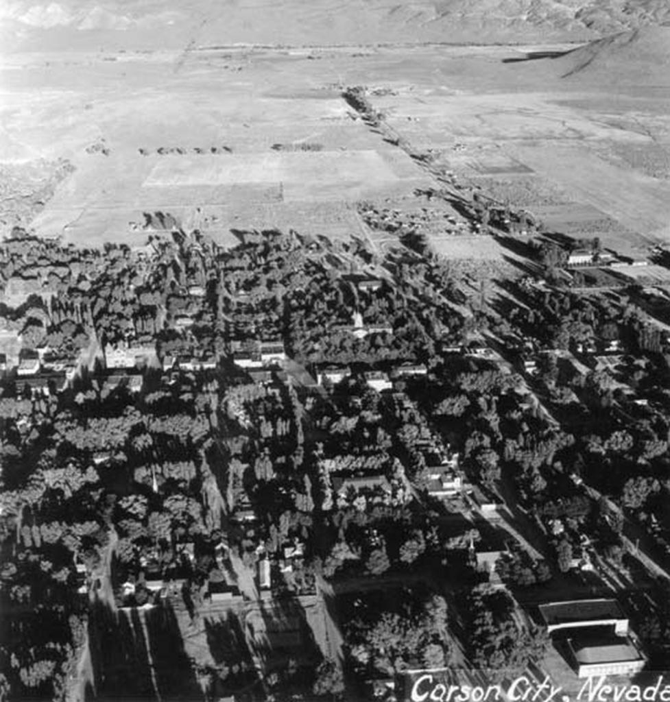
Date of photo:
1939
Photographer:
Unknown
Source :
Nevada Appeal, November 16, 2008
This photo looks down on Carson City in late afternoon, with the trees casting long shadows over everything. These deep shadows make it hard to identify landmarks. The Capitol dome stands out in the center, as does the Post Office a few blocks to the left. At the lower right is probably the most prominent building in the picture, the Carson City High School on Thompson Street.
Carson City here stops at Roop Street, and this shot gives us a great view of the Eagle Valley stretching out to the Carson River and the mountains. Much of that land today has been developed, but some of it still remains open as the Lompa Ranch. Fifth Street can be seen on the right making its way out to the State Prison, on the site of Abe Curry's Warm Springs Hotel. The prison is all by itself in the middle of nothing. At the right edge of the photo the bright wall of the Nevada State Children's Home can be seen, along Fifth between Stewart and Roop. And it seems that a primordial Saliman Road cuts across the valley, little more than a country lane lined with a few spaced-out trees.
← Previous Photo

Auto Parade
Next Photo →
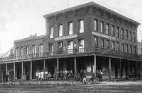
Briggs House