Available Sizes: 1024x712 | 2048x1425 | 7499x5218
Download: JPG (4734 KB)
Date Uploaded: May 22, 2024
Permanent Link: http://wnhpc.com/details/fb948wy8530
Source: Stanford Libraries
Source URL: https://exhibits.stanford.edu/mining/catalog/fb948wy8530
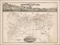
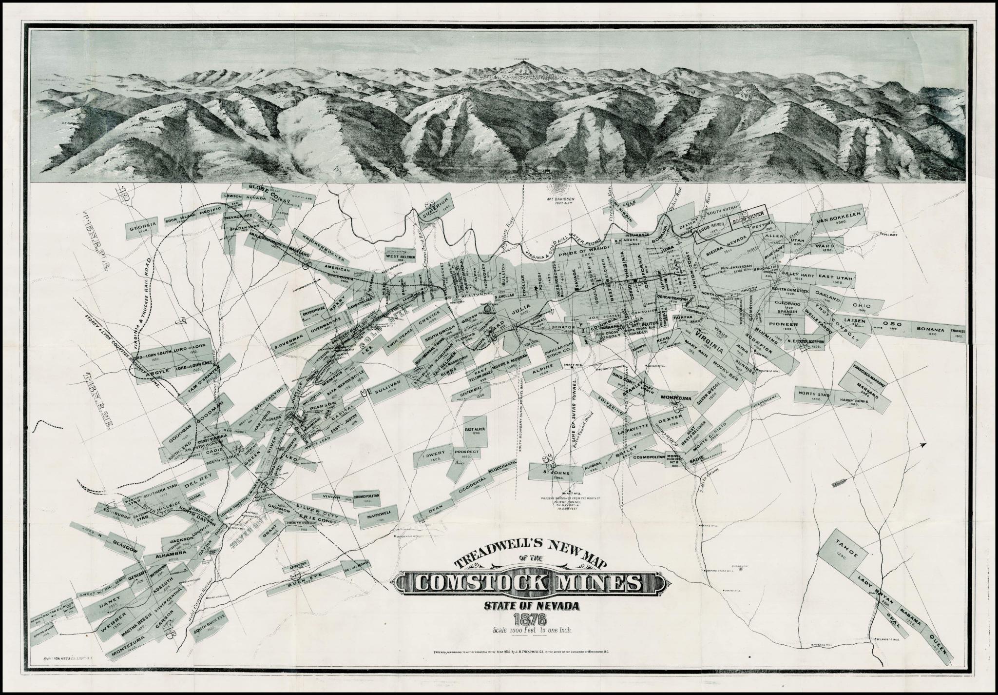
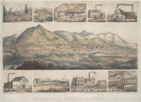
Source Caption: Rare large format map of the Comstock mining region, with a large birdseye view across the top, showiing the town of Virginia City in the foreground and Mount Davidson in the distance. The mapshows name, location, and size of all Comstock Mines. Includes railroad lines, flumes, rivers, roads, mine shafts, etc. The town plan for Virginia City appears, as does the extent of construction on the Sutro Tunnel. An important early Comstock mining map, which rarely appears on the market.
Download Photo: JPG (4734 KB)
← Previous Photo
Next Photo →