← Previous Photo
Downtown Reno Aerial
Next Photo →
Carson City Map

Carson City Map

Date of photo: 1970s
Photographer: Unknown

Source: Reddit: GeorgeWingfield

Tags: carsoncity, map,

Available Sizes: 561x800 | 718x1024 | 1436x2048 | 4328x6170

Description

A map of Carson City from the 1970s.

Actions

⇓ Download This Photo

To download this photo, choose a size below, then right-click and select "Save As".

140x200 | 175x250 | 350x500 | 561x800 | 718x1024 | 1436x2048 | 4328x6170

⇓ Embed This Photo

To embed this photo in a blog or web page, choose a size below, then copy and paste the HTML or wiki code from the box.

140x200 | 175x250 | 350x500 | 561x800

HTML code

Wiki markup

Other Data

Date Uploaded: October 18, 2023

Permanent Link: http://wnhpc.com/details/map0019

Contributor: Reddit: GeorgeWingfield

Source: Reddit: GeorgeWingfield

Source URL: https://www.reddit.com/r/carsoncity/comments/156tqct/map_of_carson_city_from_the_early_1970s/

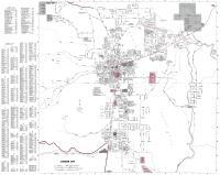
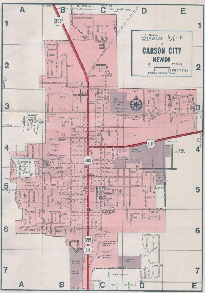
Source Caption: Map Of Carson City From The Early 1970's.


Post A Comment