
← Previous Photo | Next Photo → |
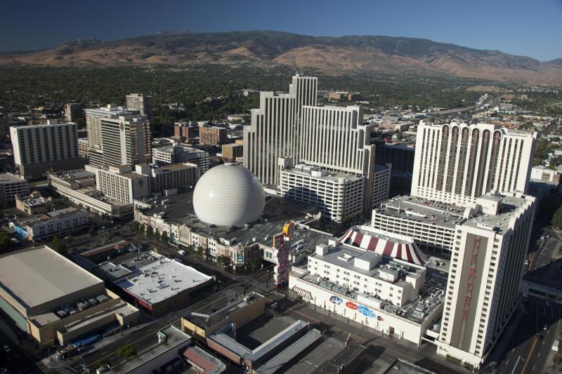
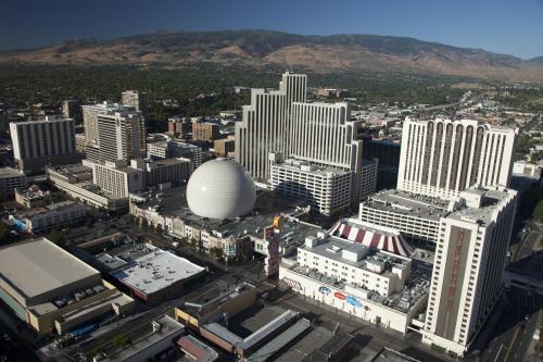
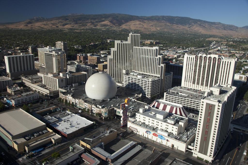
Downtown Reno Aerial
Date of photo: 2010
Photographer: Unknown
Source: Reddit: GeorgeWingfield
Description
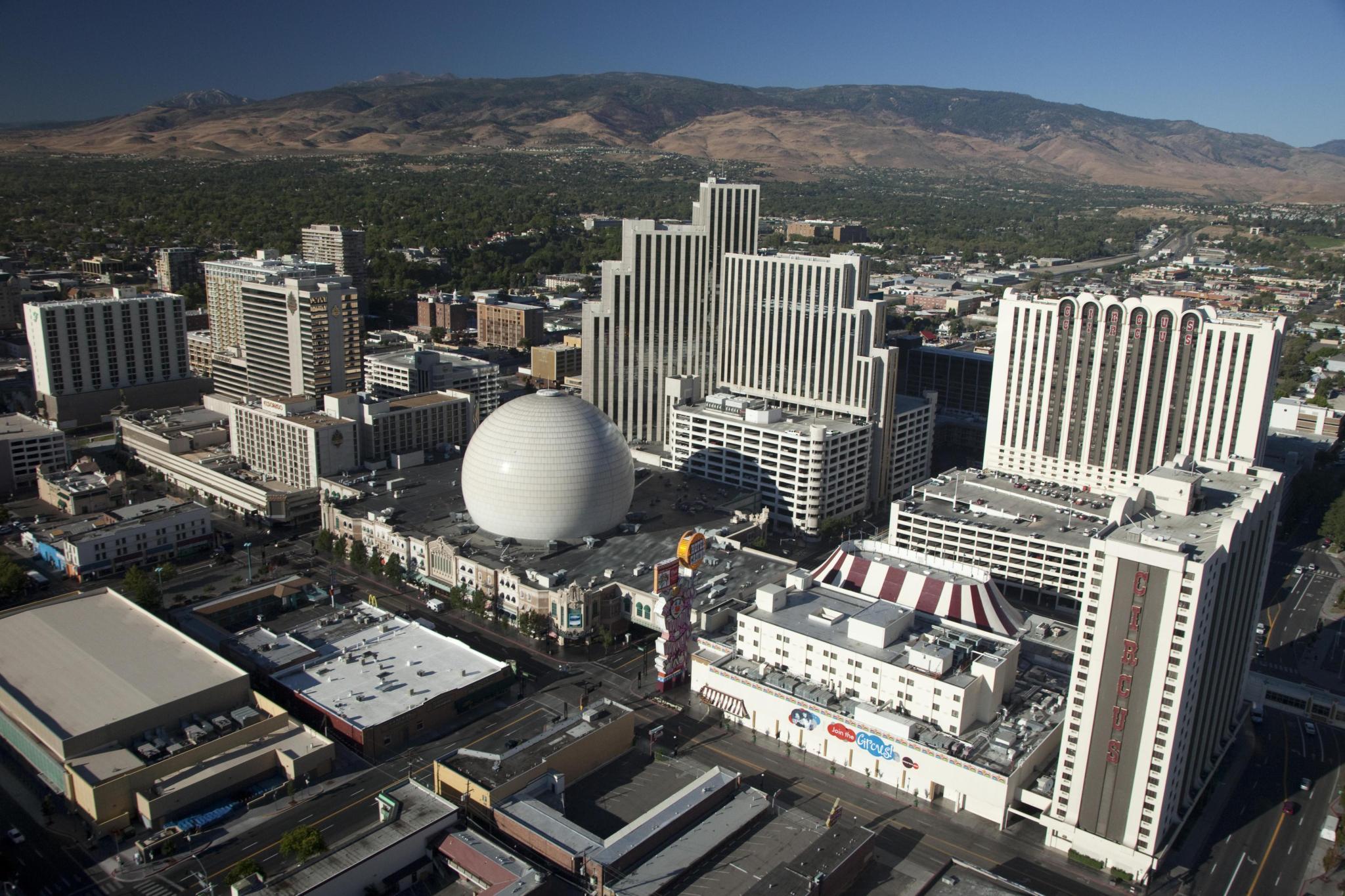
An aerial view of downtown Reno and the three largest casinos downtown. From left to right they are the Eldorado, Silver Legacy, and Circus Circus. At the bottom of the photo are several motels along Virginia Street that were torn down.
Actions
⇓ Download This Photo
⇓ Embed This Photo
Other Data
Date Uploaded: October 18, 2023
Permanent Link: http://wnhpc.com/details/photo1551
Source: Reddit: GeorgeWingfield
Source URL: https://www.reddit.com/r/Reno/comments/16zsswt/downtown_reno_in_2010/
Source Caption: Downtown Reno In 2010!
Post A Comment