Photographer:
Unknown
Source :
The Silver Short Line
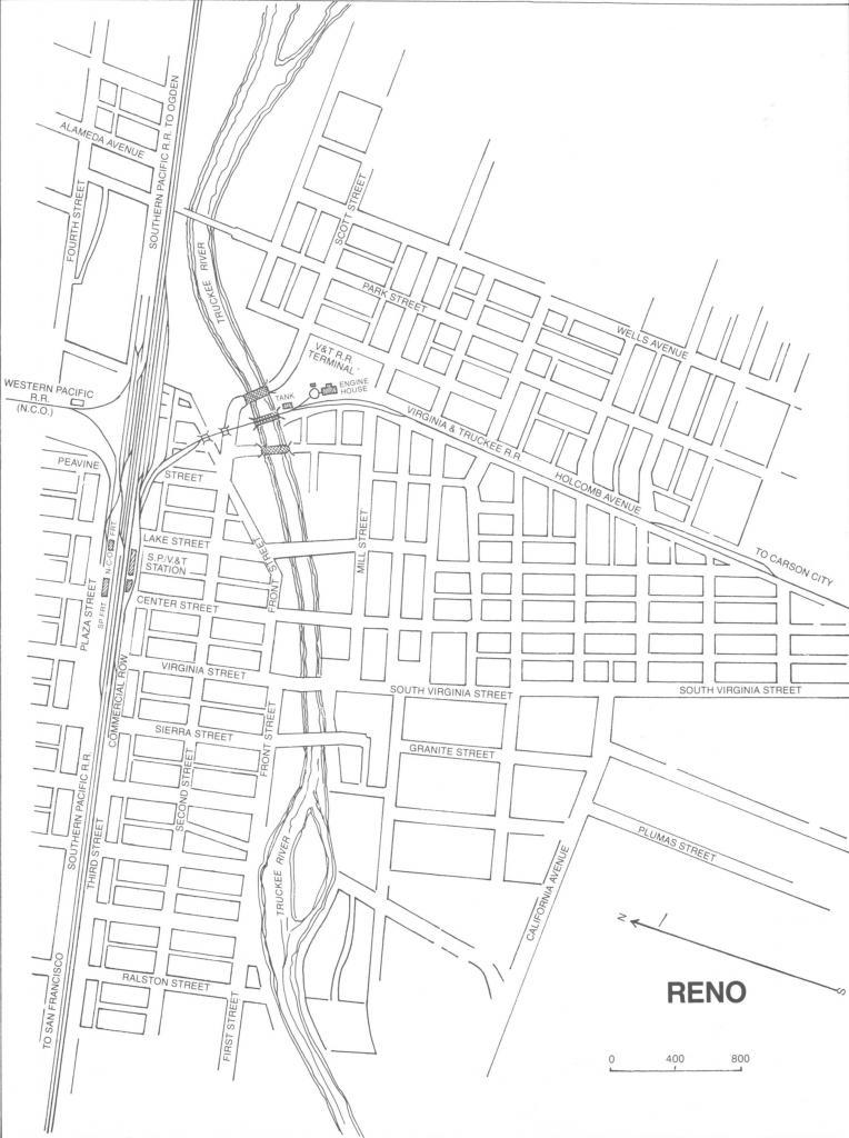
This map depicts downtown Reno, as it was during the days when the railroad ruled. Thus the railroad tracks and buildings are shown in detail.
Running east to west through town was the Transcontinental Railroad, which was built by the Central Pacific. The passenger depots were all right in the center of town, just to the east of Center Street. Past that was the main CP railyards. The Virginia and Truckee tracks branched off to the south. They crossed the Truckee River just outside of downtown, and ran through the V&T yards. The V&T yards consisted of the mainline, a spur line for passing, the single-stall enginehouse with turntable, and a water tank.
The Nevada California Oregon Railway tracks branched off the north.
← Previous Photo
Downtown Reno Rails
Next Photo →
The Suicide of Engine 26