Available Sizes: 1024x769 | 2048x1538 | 6708x5038
Download: JPG (4504 KB)

Date Uploaded: May 22, 2024
Permanent Link: http://wnhpc.com/details/qk633rh0987
Source: Stanford Libraries
Source URL: https://exhibits.stanford.edu/mining/catalog/qk633rh0987
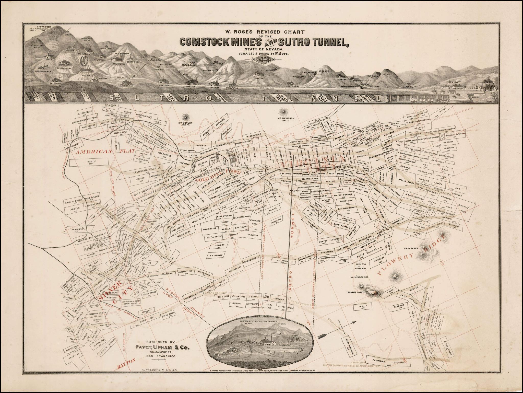
Source Caption: Detailed map and birdseye view of the Comstock region, lithographed by Waldstein in San Francisco. The map shows the area around Virginia City, Gold Hill Town, American Flat, Silver City, Dayton and Flowery Ridge, along with the lines of the Virginia & Truckee Railroad and the Silver City Branch Railroad, along with the Sutro Tunnel Road, Seven Mile Canyon Road and the American Flat Road. The Virginia & Gold HIll Water Flune is also shown. The birdseye view is centered on Dayton and names over three dozen mils, illustrating their locations. At the bottom margin in center is an oval landscape engraving entitled The Mouth of the Sutro Tunnel; Map is printed in black and red with all major locations in bold red type and individual mines and tunnels in black and boundary lines of Sutro tunnel in red. The map is quite scarce, this being one of only a few examples to appear on the market in the last 20 years.
Download Photo: JPG (4504 KB)