Virginia City Map

Tags: map , virginiacity

Date of photo: 1954

Photographer: Robert Lewis Richards

Source : Raremaps.com

Available Sizes: 1024x797 | 2000x1558

Download: JPG (609 KB)

Description

A hand-drawn tourist map of Virginia City from 1954. Many historic landmarks and then-current shops are marked on the map.

Other Data

Date Uploaded: July 22, 2024

Permanent Link: http://wnhpc.com/details/photo1823

Source: Raremaps.com

Source URL: https://www.raremaps.com/gallery/detail/82454/a-birds-eye-view-of-the-central-portion-of-virginia-city-st-richards

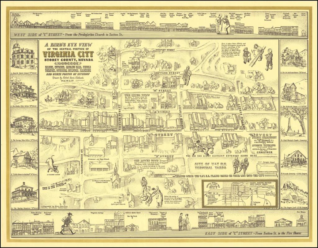
Source Caption: A Bird's Eye View of the Central Portion of Virginia City Storey County, Nevada Showing Saloon, Churches, Gambling Halls, Schools, Theatres, Municipal Buildings, Mansions and other Points of Interest . . . MCMLIV

Download Photo: JPG (609 KB)

Location

← Previous Photo

Consolidated and California Mine

Next Photo →

Virginia City