Roop Street Aerial

Tags: aerial , carsoncity

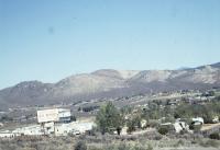
Date of photo: 1980s

Photographer: Unknown

Source : Scanned Slide

Available Sizes: 1024x694 | 1800x1221

Download: JPG (237 KB)

Description

An aerial view of a couple of blocks of Roop Street in Carson City. The streets on the left and right are Musser and Second. The block in the upper half of the photo was the future home of the Carson City Courthouse.

Other Data

Date Uploaded: October 31, 2023

Permanent Link: http://wnhpc.com/details/photo1608

Source: Scanned Slide

Download Photo: JPG (237 KB)

← Previous Photo

V&T Enginehouse

Next Photo →

Entering Carson City