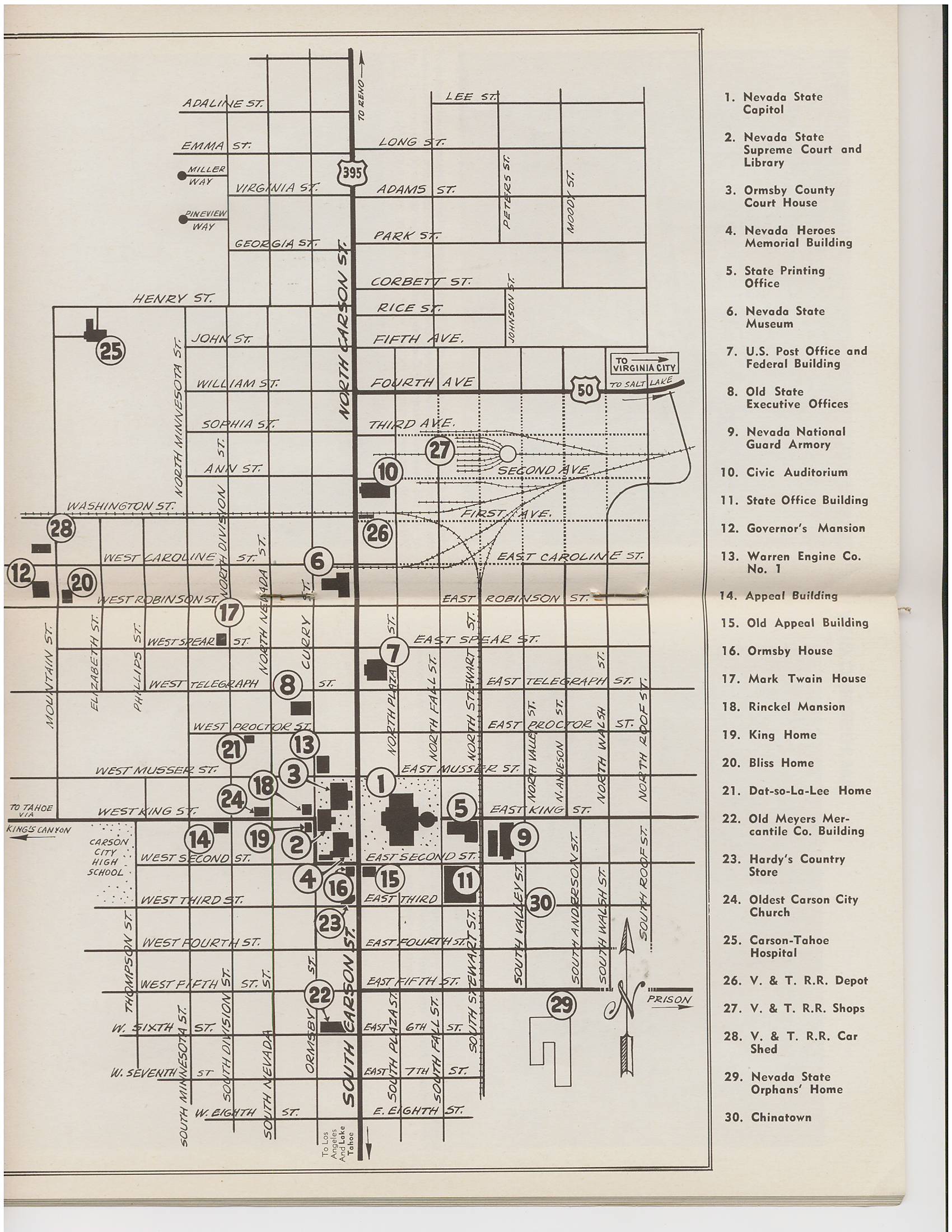
A tourist map of downtown Carson City, from the booklet "Hardy's Pictorial Carson City Guide and Map." Most of what's noted on the map is still there today, but there are a few notable changes. #15 and #11, the old Nevada Appeal building and the Nye building, were torn down to build the Capitol Plaza and Supreme Court. #25 shows the old hospital, which burned and was replaced in the 1960s. #27 and #28 show V&T buildings that are lost, the old stone enginehouse on Stewart Street and the wooden enginehouse next door to the Governor's Mansion. #22, the old Meyers Mercantile, was torn down to build the Ormsby House in the 70s. #29, the stone Orphanage, was torn down for the children's cottages in the 60s. I'm not familiar with #8 on Curry Street. It says it is "Old State Executive Offices". There was a bank on that site until the 2010s, and now there is a new retail/residential building. The state offices must predate the bank.
#23 is Hardy's Country Store, presumably where this guide book could be bought. That spot has been Mom and Pop's restaurant for many years.
← Previous Photo

Sargent House
Next Photo →
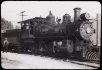
Virginia and Truckee #26
