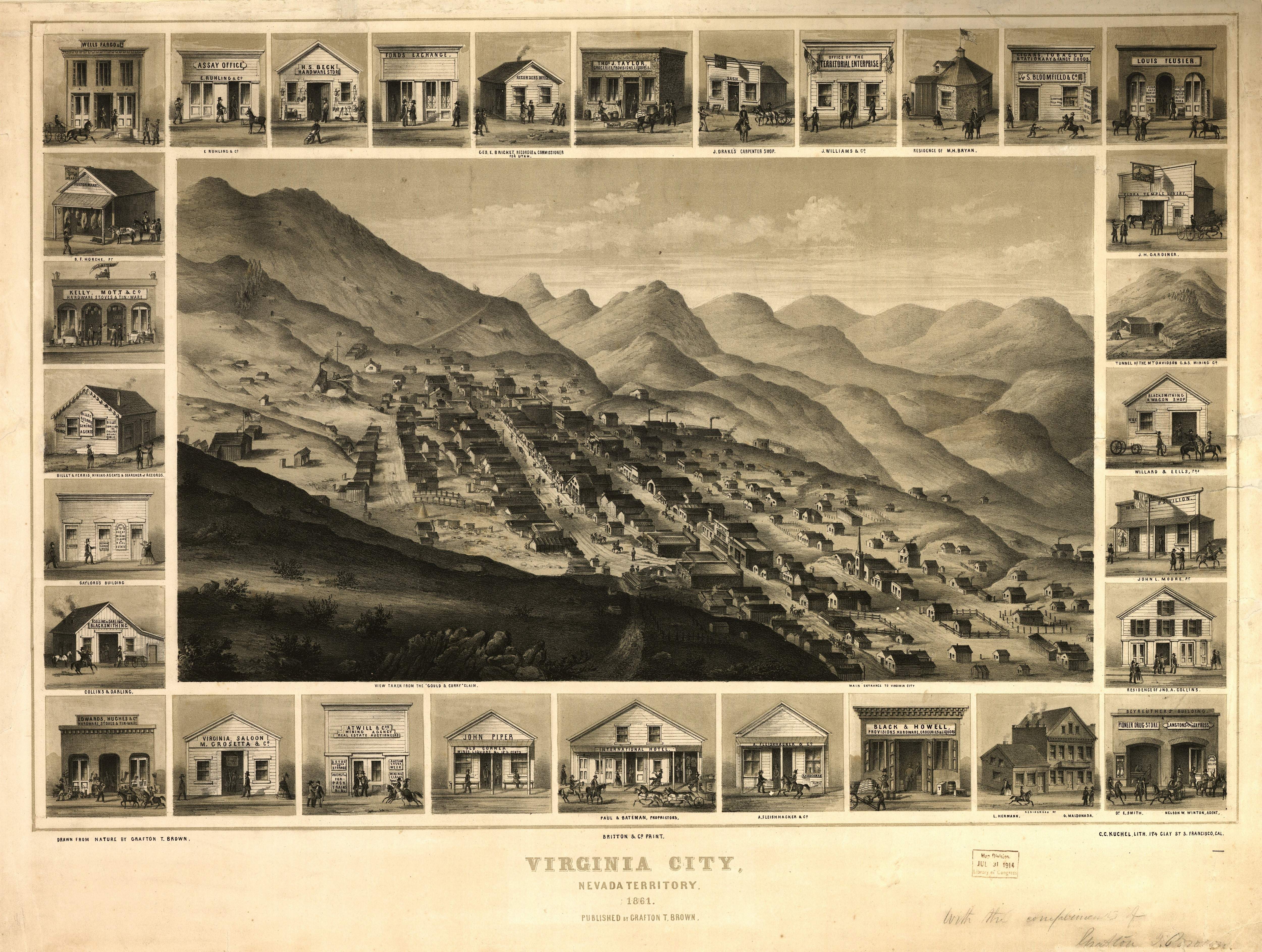
Long before any photographic equipment arrived on the Comstock, Grafton T. Brown came to town and drew this very realistic map, as imagined perhaps from a hot air balloon, high above the Divide. At this point Virginia City was only a couple of years old, and Nevada was still a Territory, not a state. But the promise of gold, and later the even richer promise of silver, brought desperate miners to this town quickly in hopes of being the first to stake out a lucrative claim. Already the slopes of Mount Davidson are littered with wooden shacks.
Several of those shacks are detailed around the margins. Many of them are forgotten to history, but some can be seen whose names still ring true today. International Hotel, Piper's Saloon (later to become an opera house), Territorial Enterprise.
← Previous Photo
Bird's Eye View of Virginia City
Next Photo →
Kit Carson