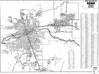
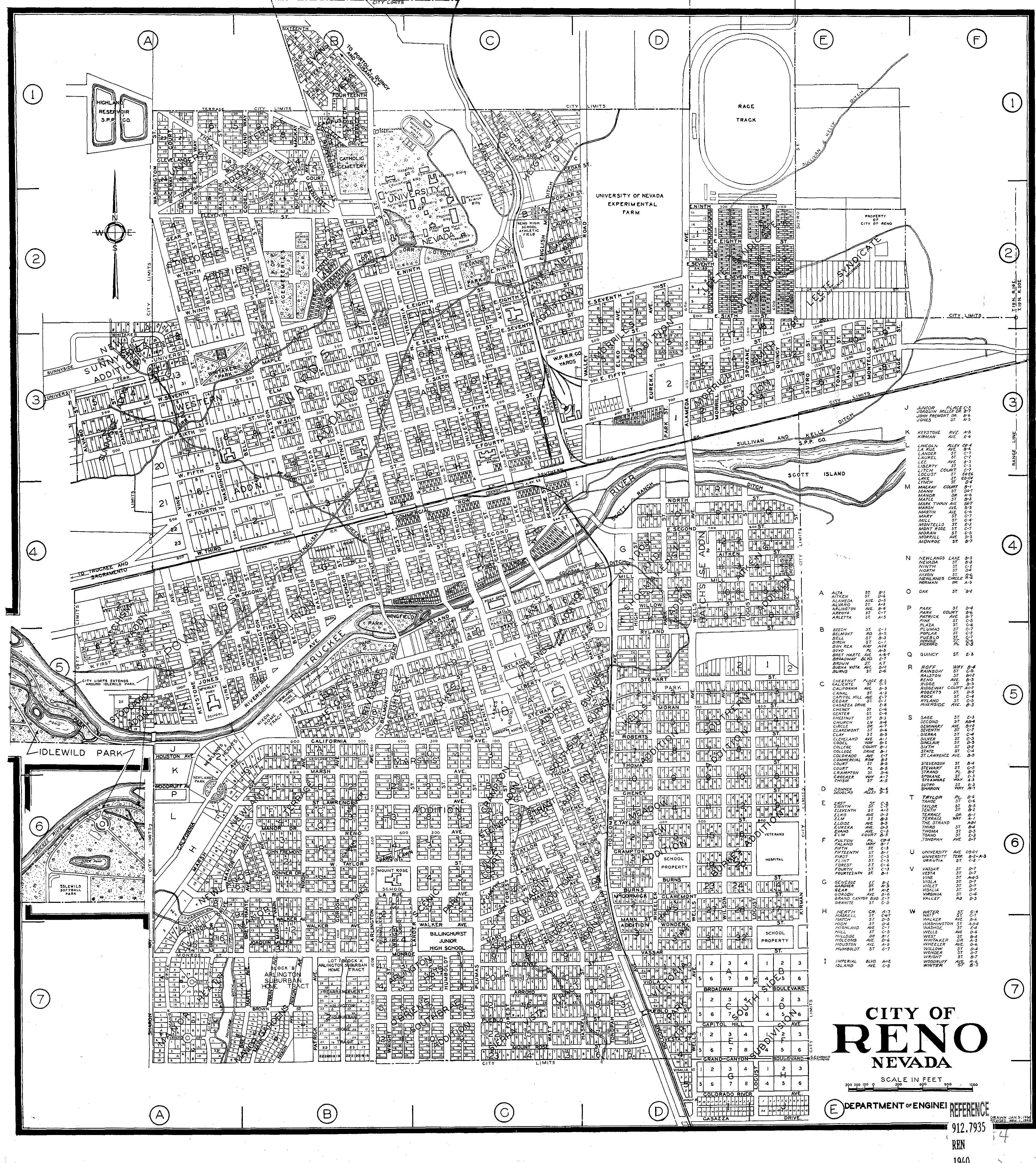
← Previous Photo
Nevada State Printing Office
Next Photo →
Map of Reno, 1954

Map of Reno, 1940

Date of photo: 1940
Photographer: Unknown

Source: http://www.dwgt.net/nv/city/reno/1940.jpg

Tags: map, reno,

Available Sizes: 712x800 | 912x1024 | 1824x2048 | 4074x4573

Description

Actions

⇓ Download This Photo

To download this photo, choose a size below, then right-click and select "Save As".

178x200 | 222x250 | 445x500 | 712x800 | 912x1024 | 1824x2048 | 4074x4573

⇓ Embed This Photo

To embed this photo in a blog or web page, choose a size below, then copy and paste the HTML or wiki code from the box.

178x200 | 222x250 | 445x500 | 712x800

HTML code

Wiki markup

Other Data

Date Uploaded: July 29, 2009

Permanent Link: http://wnhpc.com/details/map0002

Source: http://www.dwgt.net/nv/city/reno/1940.jpg


Post A Comment