Sanborn Map Carson City 1941 Sheet 6

Tags: carsoncity , map , sanbornmap

Date of photo: August 1941

Photographer: Sanborn Map Company

Source : Library of Congress

Available Sizes: 864x1024 | 1729x2048 | 6510x7707

Download: JPG (2182 KB)

Library of Congress Geography and Map Division

Description

The Sanborn Fire Insurance Map of Carson City from 1941. This is a revised edition of the 1907 map. Sheet 6.

Other Data

Date Uploaded: March 17, 2025

Permanent Link: http://wnhpc.com/details/loc05279194106

Source: Library of Congress

Source URL: https://www.loc.gov/item/sanborn05279_004/

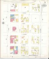
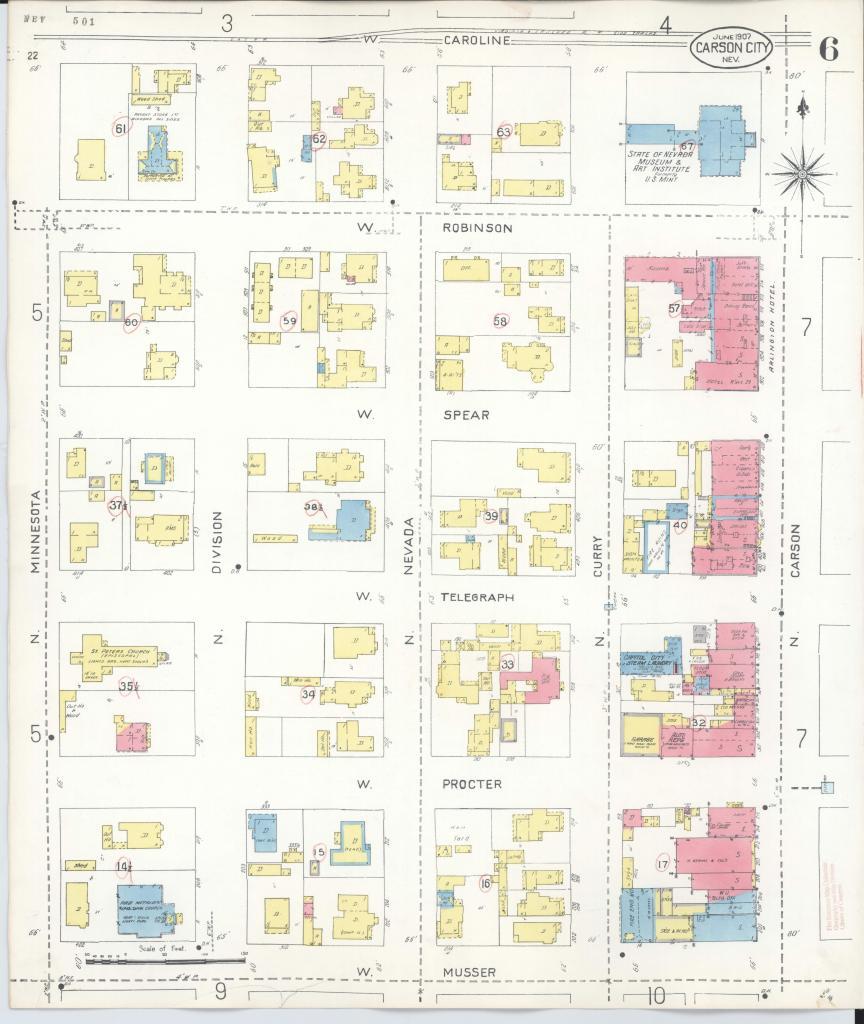
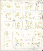
Source Caption: Sanborn Fire Insurance Map from Carson City, Carson City County, Nevada.

Download Photo: JPG (2182 KB)

← Previous Photo

Sanborn Map Carson City 1941 Sheet 5

Next Photo →

Sanborn Map Carson City 1941 Sheet 7