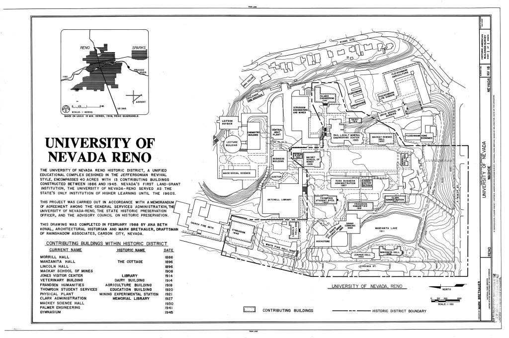
Date of photo: February 1988
Photographer: Mark Brethauer
Source : Historic American Buildings Survey (Library of Congress)
Date Uploaded: April 19, 2024
Permanent Link: http://wnhpc.com/details/habsnv0102
Source: Historic American Buildings Survey (Library of Congress)
Source URL: https://www.loc.gov/item/nv0102/
Source Caption: University of Nevada (Site Plan), Evans, Virginia & Ninth Street, Reno, Washoe County, NV Drawings from Survey HABS NV-18
Download Photo: JPG (920 KB)
← Previous Photo
Next Photo →