← Previous Photo
C Street, Virginia City
Next Photo →
The Lander Sign

B Street, Virginia City

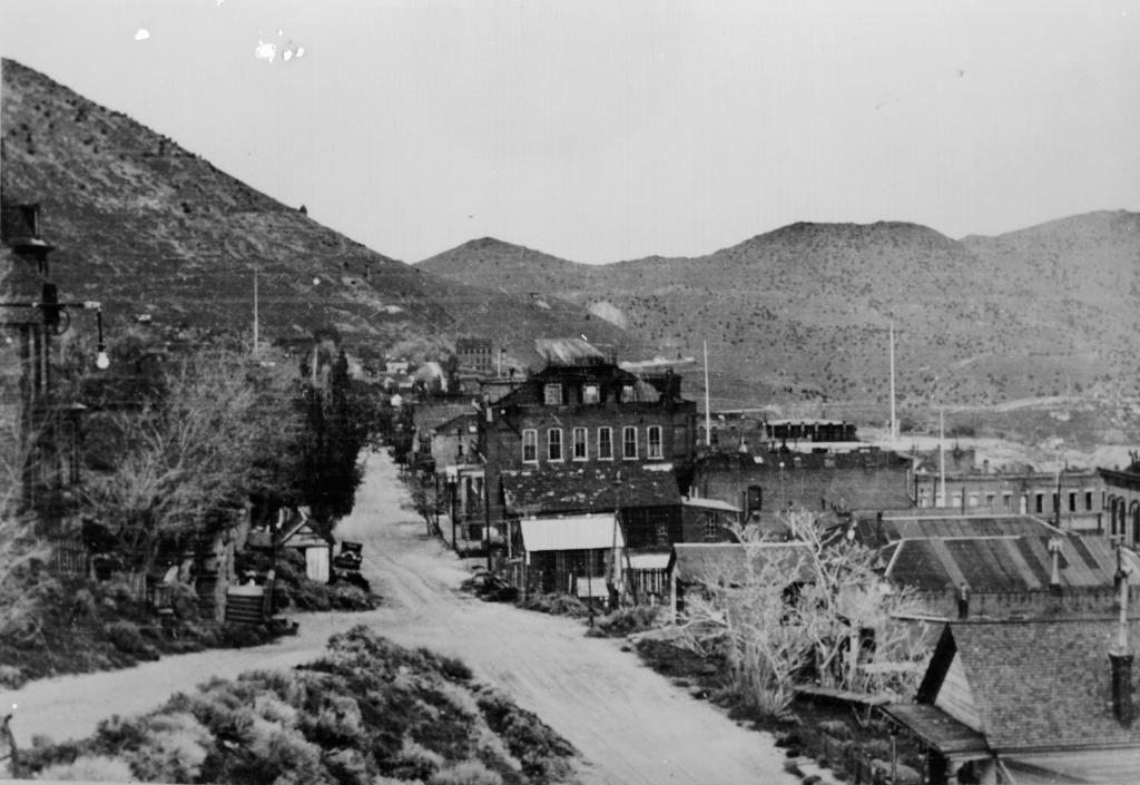
Date of photo: August 1940
Photographer: William H. Knowles

Source: Historic American Buildings Survey (Library of Congress)

Tags: bstreet, maryebuilding, virginiacity,

Available Sizes: 800x550 | 1024x705 | 2048x1410 | 4405x3033

Library of Congress

Description

B Street in Virginia City, looking north. B Street was mostly a residential street, in contrast to the business district on C Street. In the center is the Marye Building.

Actions

⇓ Download This Photo

To download this photo, choose a size below, then right-click and select "Save As".

200x137 | 250x172 | 500x344 | 800x550 | 1024x705 | 2048x1410 | 4405x3033

⇓ Embed This Photo

To embed this photo in a blog or web page, choose a size below, then copy and paste the HTML or wiki code from the box.

200x137 | 250x172 | 500x344 | 800x550

HTML code

Wiki markup

Other Data

Date Uploaded: January 19, 2024

Permanent Link: http://wnhpc.com/details/habs104125pu

Source: Historic American Buildings Survey (Library of Congress)

Source URL: https://www.loc.gov/item/nv0065/

Source Caption: Historic American Buildings Survey, Wells Fargo Bank Historical Museum, S.F. Re-photo: August 1940 GENERAL VIEW - Virginia City, General View Area Survey, Virginia City, Storey County, NV Photos from Survey HABS NV-15-77


Post A Comment