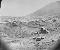
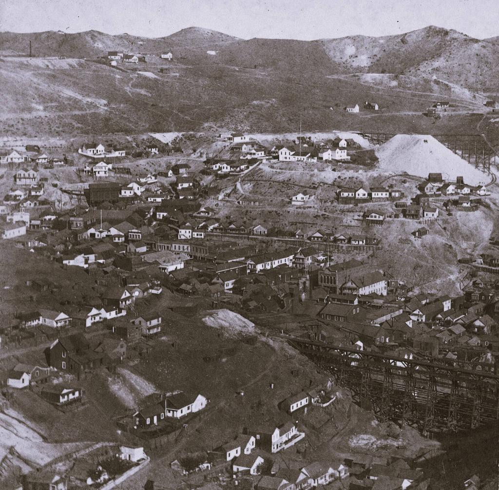
Date of photo: 1870s
Photographer: Carleton Watkins
Date Uploaded: July 2, 2024
Permanent Link: http://wnhpc.com/details/fb921380543362606
Contributor: Nevada Ghost Towns and Historic Sites on Facebook
Source: Facebook: Nevada Ghost Towns and Historic Sites
Source URL: https://www.facebook.com/photo?fbid=921380543362606&set=a.465020845665247
Source Caption: This remarkable 1870s photograph, captured by the renowned historic photographer Carleton Watkins, offers a view from the Ophir Grade high above Gold Hill, Nevada. In the lower right, you can see the Crown Point Trestle spanning Bowers Canyon.
Download Photo: JPG (788 KB)
← Previous Photo
Next Photo →