Tahoe and Sierra Map

Tags: gardnerville , laketahoe , map

Date of photo: 1886

Photographer: Unknown

Source : Facebook: Stephen Gennerich

Available Sizes: 776x424

Download: JPG (112 KB)

Description

This map from 1886 shows a portion of the Lake Valley, currently South Lake Tahoe, and the path of the Lake Valley Railroad. It also shows a portion of the Carson Valley, including Sheridan and Gardnerville.

Other Data

Date Uploaded: January 2, 2017

Permanent Link: http://wnhpc.com/details/fb911802828892664

Contributor: Stephen Gennerich on Facebook

Source: Facebook: Stephen Gennerich

Source URL: https://www.facebook.com/photo.php?fbid=911802828892664&set=gm.414543525420090&type=1

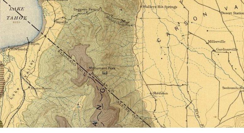
Source Caption: Here is a map of the Lake Valley Railroad tracks around 1886

Download Photo: JPG (112 KB)

← Previous Photo

Lake Valley Railroad

Next Photo →

Locomotive at Devil's Gate