← Previous Photo
Majestic Theater
Next Photo →
V&T in Reno

Reno Trolley Map

Photographer: Unknown

Source: Facebook: Stephen Gennerich

Tags: map, reno,

Available Sizes: 800x610 | 1024x781 | 2048x1563

Description

A map of downtown Reno with a particular focus on the train tracks and trolley lines that were interspersed around downtown. In this map up is east.

Actions

⇓ Download This Photo

To download this photo, choose a size below, then right-click and select "Save As".

200x152 | 250x190 | 500x381 | 800x610 | 1024x781 | 2048x1563

⇓ Embed This Photo

To embed this photo in a blog or web page, choose a size below, then copy and paste the HTML or wiki code from the box.

200x152 | 250x190 | 500x381 | 800x610

HTML code

Wiki markup

Other Data

Date Uploaded: January 22, 2017

Permanent Link: http://wnhpc.com/details/fb665712463501703

Contributor: Stephen Gennerich on Facebook

Source: Facebook: Stephen Gennerich

Source URL: https://www.facebook.com/photo.php?fbid=665712463501703&set=gm.240932559447855&type=1

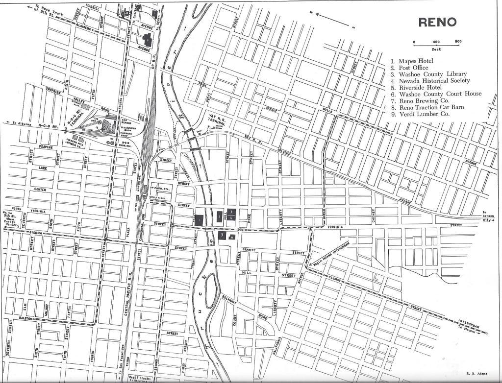
Source Caption: Here is the map of the trolley routes. Notice north of Central Pacific Railroad Station is another Railroad Station. The Nevada-California-Oregon Railroad started in 1880 to carry passengers from Reno to NE California and Oregon.


Post A Comment