← Previous Photo
Stateline
Next Photo →
Wells Fargo Ruins and St Mary's

Cave Rock

Photographer: Unknown

Source: Facebook: Nevada Armored Transport, Inc. 1946-1984

Tags: caverock, laketahoe,

Available Sizes: 509x800 | 651x1024 | 999x1569

Description

An early road passing by Cave Rock on the shore of Lake Tahoe. This was before tunnels were carved through the rock. The road back then followed a precarious path on the outside of the rock.

Actions

⇓ Download This Photo

To download this photo, choose a size below, then right-click and select "Save As".

127x200 | 159x250 | 318x500 | 509x800 | 651x1024 | 999x1569

⇓ Embed This Photo

To embed this photo in a blog or web page, choose a size below, then copy and paste the HTML or wiki code from the box.

127x200 | 159x250 | 318x500 | 509x800

HTML code

Wiki markup

Other Data

Date Uploaded: July 11, 2021

Permanent Link: http://wnhpc.com/details/fb5600542843349643

Contributor: Nevada Armored Transport, Inc. 1946-1984 on Facebook

Source: Facebook: Nevada Armored Transport, Inc. 1946-1984

Source URL: https://www.facebook.com/NevadaArmoredTransport/posts/5600557286681532

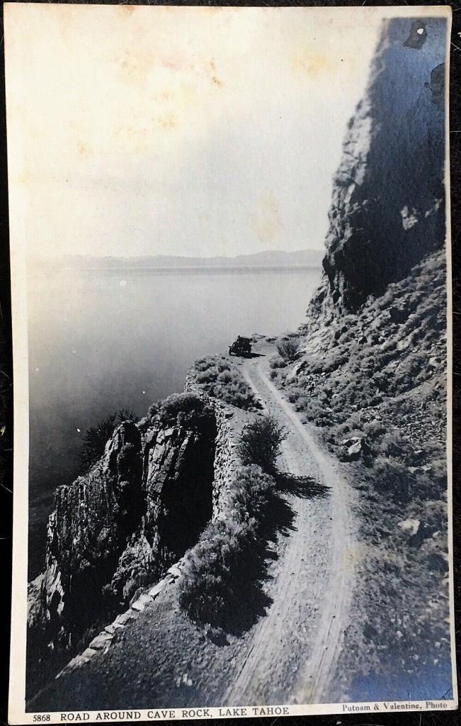
Source Caption: Postcard photo of the road around Cave Rock, Lake Tahoe, Nevada c. 1907/1912. A Putnam & Valentine photo


Post A Comment