← Previous Photo
Downtown Reno
Next Photo →
Idlewild Park

Reno Map

Date of photo: 1907
Photographer: Unknown

Source: Facebook: Ken Clark

Tags: downtownreno, map, reno,

Available Sizes: 800x559 | 1024x716 | 2002x1400

Description

A handdrawn map of Reno in 1907. It focuses on the downtown core, with the outskirts of town stretching off to the distance. Photos of several downtown businesses are around the border of the map.

Actions

⇓ Download This Photo

To download this photo, choose a size below, then right-click and select "Save As".

200x139 | 250x174 | 500x349 | 800x559 | 1024x716 | 2002x1400

⇓ Embed This Photo

To embed this photo in a blog or web page, choose a size below, then copy and paste the HTML or wiki code from the box.

200x139 | 250x174 | 500x349 | 800x559

HTML code

Wiki markup

Other Data

Date Uploaded: November 25, 2020

Permanent Link: http://wnhpc.com/details/fb4609486649125967

Contributor: Ken Clark on Facebook

Source: Facebook: Ken Clark

Source URL: https://www.facebook.com/photo/?fbid=4609486649125967&set=gm.3579731732092267

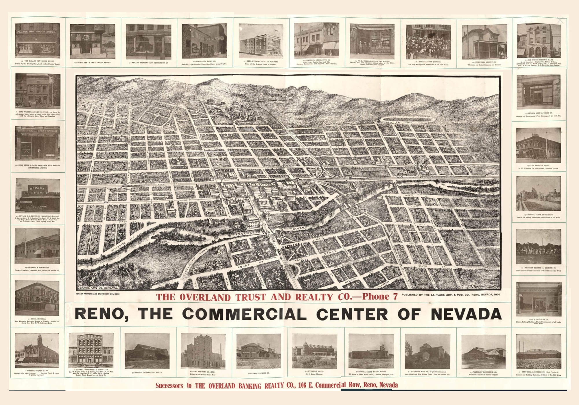
Source Caption: A wonderful map of Reno from 1907. Slightly blurred but nevertheless pretty awesome. It's pretty detailed if you blow it up.


Post A Comment