Date Uploaded: May 14, 2025
Permanent Link: http://wnhpc.com/details/fb23954269847510199
Contributor: Philip Galbraith on Facebook
Source: Facebook: Philip Galbraith
Source URL: https://www.facebook.com/groups/276615248516/permalink/10161911841303517/
Source Caption: Here is a rare photo of the old Riverside... when it wasn't there! 🤓
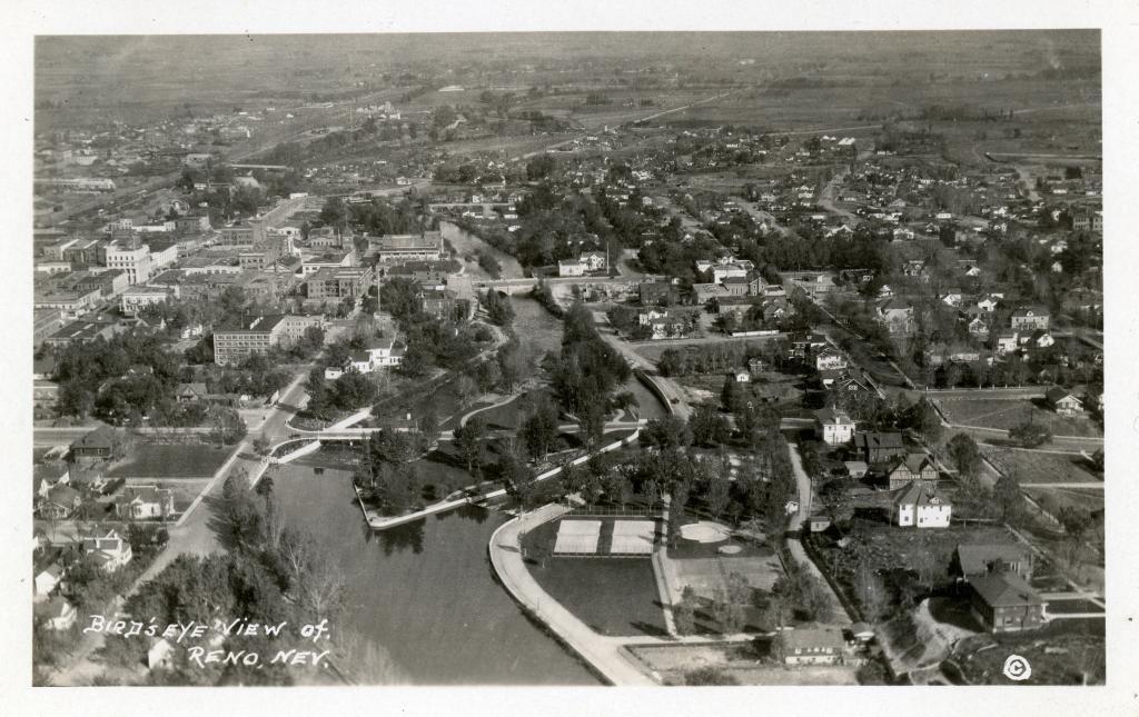
The top picture is from a Reno Postcard, the photo taken from an aircraft looking east. You can see the Truckee River making its way through town.
In the bottom photo I zoomed in on Virginia Street at the river. On the left you can see the Virgnia Street Bridge and on the right you can see the back of the Washoe County Court House. However what you do not see is the beloved Riverside Hotel between the bridge and the court house!
The first brick Riverside was destroyed by fire in March of 1922. The Riverside that stands there today was built in 1927. But in this photo, if you look really close, is Rubble of the burned out 1922 Riverside! A Rare Site!
Download Photo: JPG (775 KB)
← Previous Photo
Next Photo →