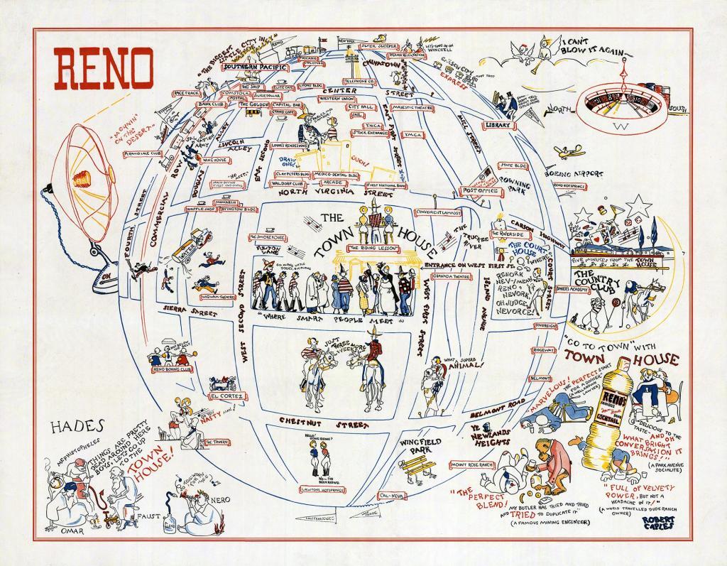
Date of photo: 1935
Photographer: Robert Caples
Date Uploaded: July 1, 2018
Permanent Link: http://wnhpc.com/details/fb2254665597878776
Contributor: Special Collections, UNR Libraries on Facebook
Source: Facebook: Special Collections, UNR Libraries
Source Caption: One of our favorite maps here is a circa 1935 cartoon map of Reno illustrated by Robert Caples to promote the Town House.
(P.S. It looks even better if you choose "enter full screen" from the options menu in the lower right corner).
Download Photo: JPG (832 KB)
← Previous Photo
Next Photo →