← Previous Photo
Silver City
Next Photo →
Hotel Mapes

Truckee River

Date of photo: 1920
Photographer: Unknown

Source: Facebook: Larry Hewitt

Tags: downtownreno, reno, truckeeriver, wingfieldpark,

Available Sizes: 800x497 | 1024x636 | 1820x1131

Description

The Truckee River in downtown Reno. The Arlington Street bridge is in the center, in this view looking to the west. Riverside Drive follows the river. To the left is Belle Isle, later known as Wingfield Park.

Actions

⇓ Download This Photo

To download this photo, choose a size below, then right-click and select "Save As".

200x124 | 250x155 | 500x310 | 800x497 | 1024x636 | 1820x1131

⇓ Embed This Photo

To embed this photo in a blog or web page, choose a size below, then copy and paste the HTML or wiki code from the box.

200x124 | 250x155 | 500x310 | 800x497

HTML code

Wiki markup

Other Data

Date Uploaded: April 7, 2021

Permanent Link: http://wnhpc.com/details/fb2239788972821850

Contributor: Larry Hewitt on Facebook

Source: Facebook: Larry Hewitt

Source URL: https://www.facebook.com/photo/?fbid=2239788972821850&set=gm.1620860401455057

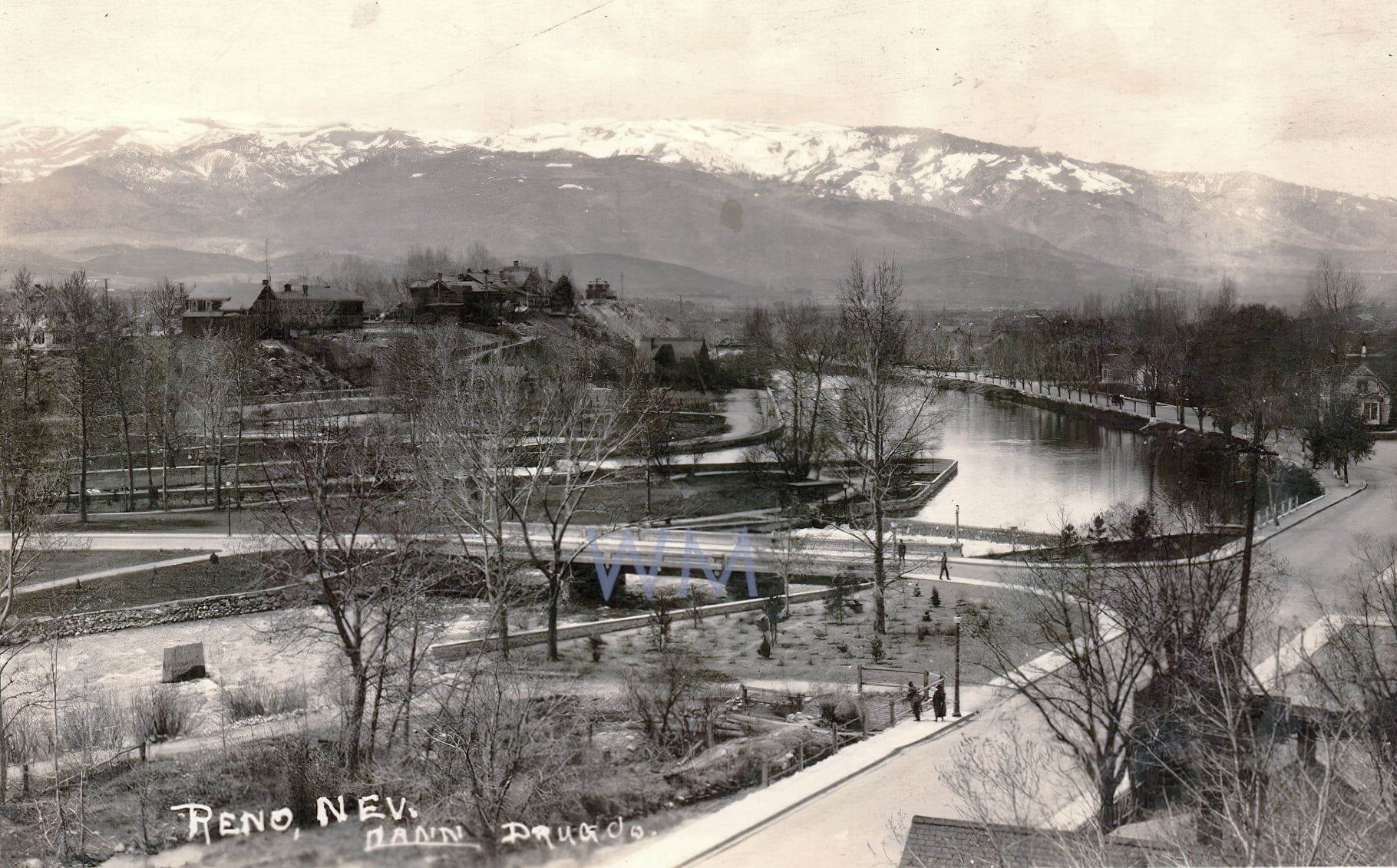
Source Caption: Reno, NV - Truckee river & bridge circa 1920. Riverside Drive?


Post A Comment