Tahoe City Aerial

Tags: aerial , laketahoe , tahoecity , tahoetavern , truckeeriver

Date of photo: 1939

Photographer: U.S. Forest Service

Source : Facebook: Carol Van Etten

Available Sizes: 1024x1008 | 1809x1782

Download: JPG (421 KB)

Description

An aerial view of Tahoe City, at Lake Tahoe. The Truckee River is prominent at it leaves the lake and flows downhill towards Truckee and Reno. Also visible are the scars of the right of way of the Lake Tahoe Railway and Transportation Company. The tracks came up the Truckee River Canyon from Truckee, then headed for the Tahoe Tavern, which is visible on the shoreline with two piers. The uppermost pier actually had train tracks on it so passengers could transfer directly to a steamship docked at the pier. The railroad was abandoned a few years after this photo, in favor of road transportation. Hwy 89 crosses the tracks in a north-south direction. The Tahoe City downtown is seen at the top of the photo.

Other Data

Date Uploaded: July 13, 2020

Permanent Link: http://wnhpc.com/details/fb1564452187049702

Contributor: Carol Van Etten on Facebook

Source: Facebook: Carol Van Etten

Source URL: https://www.facebook.com/photo?fbid=1564452187049702&set=pcb.1415776611963438

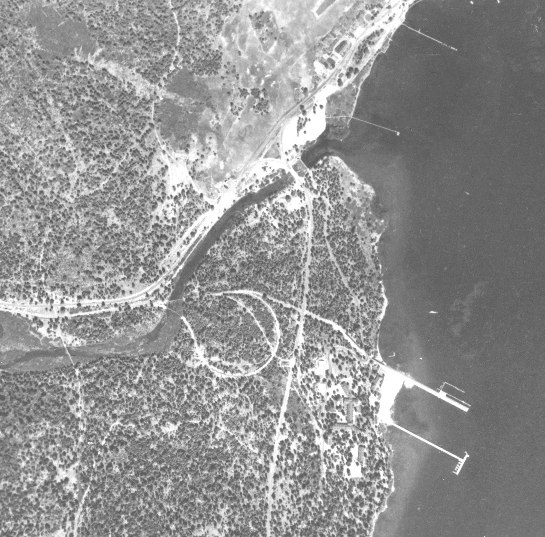
Source Caption: You might think aerial photography of Tahoe is something new, but the US Forest Service has been at it for years. Their first sky survey was conducted in 1939, and here's how Tahoe City looked then. The loop near the center of the photo is the railroad "balloon track", which allowed the train to reverse direction and back out onto the Tahoe Tavern pier.

Download Photo: JPG (421 KB)

← Previous Photo

Stateline Aerial

Next Photo →

Cave Rock