Truckee Meadows Map

Tags: map , reno , sparks , truckeemeadows

Date of photo: 1921

Photographer: Unknown

Source : Facebook: Dan Olguin

Available Sizes: 1024x747 | 2048x1494

Download: JPG (1444 KB)

Description

A map of Reno, Sparks, and the surrounding parts of the Truckee Meadows. This map shows the ownership of all the land outside the town boundaries.

Other Data

Date Uploaded: May 14, 2025

Permanent Link: http://wnhpc.com/details/fb10227398858339103

Contributor: Dan Olguin on Facebook

Source: Facebook: Dan Olguin

Source URL: https://www.facebook.com/photo/?fbid=10227398858339103&set=gm.9786424251422953&idorvanity=471050472960424

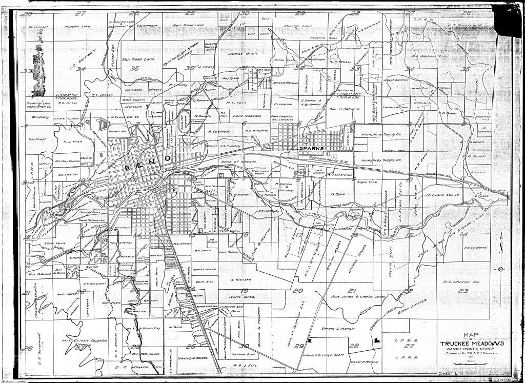
Source Caption: 1921 Truckee Meadows ranch map.

Download Photo: JPG (1444 KB)

← Previous Photo

Downtown Reno Aerial

Next Photo →

Gold Hill Hotel