← Previous Photo
Carson Nugget
Next Photo →
Jimboy's Tacos

Carson City Map

Date of photo: 1960s
Photographer: Unknown

Source: Facebook: Jed Block

Tags: carsoncity, map,

Available Sizes: 625x800 | 800x1024 | 1470x1881

Description

A map of Carson City from the 1960s. A number of motels and other businesses are marked on the map.

Actions

⇓ Download This Photo

To download this photo, choose a size below, then right-click and select "Save As".

156x200 | 195x250 | 390x500 | 625x800 | 800x1024 | 1470x1881

⇓ Embed This Photo

To embed this photo in a blog or web page, choose a size below, then copy and paste the HTML or wiki code from the box.

156x200 | 195x250 | 390x500 | 625x800

HTML code

Wiki markup

Other Data

Date Uploaded: April 15, 2021

Permanent Link: http://wnhpc.com/details/fb10224388750243347

Contributor: Jed Block on Facebook

Source: Facebook: Jed Block

Source URL: https://www.facebook.com/photo/?fbid=10224388750243347&set=gm.10159431922970097

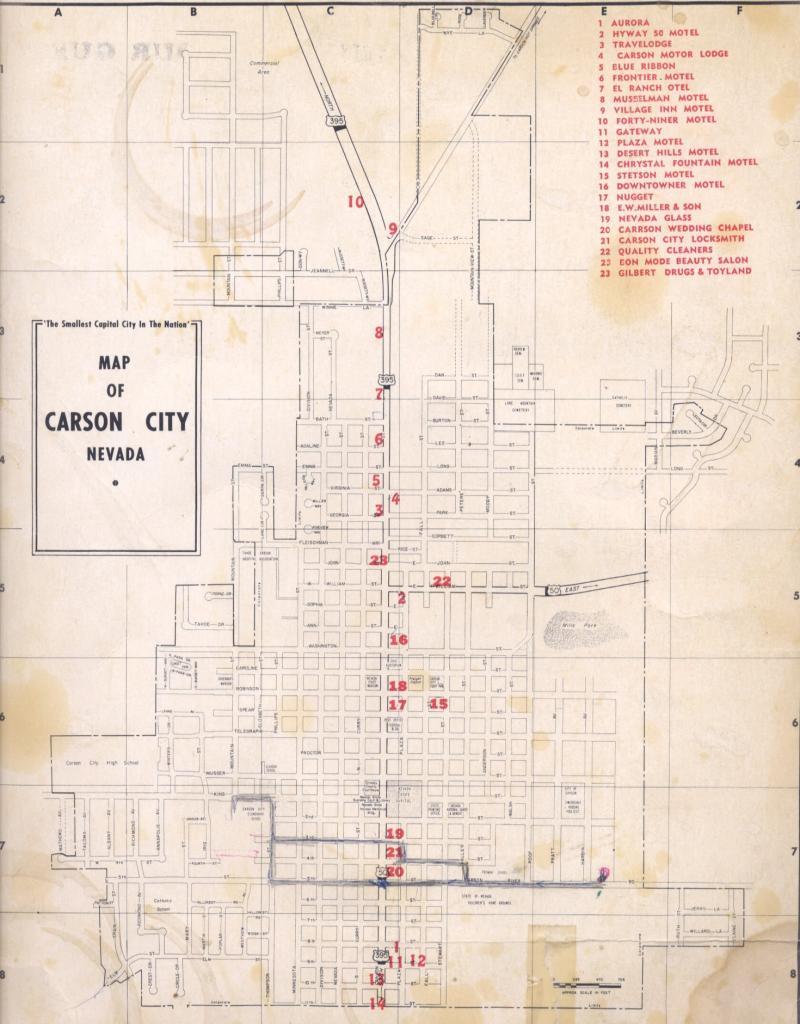
Source Caption: 1964-67 ish notice that Virginia, Emma, and Georgia (Bath family names) streets are now renamed


Post A Comment