← Previous Photo
Trader Dick's Chinese Restaurant
Next Photo →
Fleischmann Planetarium

Sparks Aerial

Date of photo: Late 1960s
Photographer: Unknown

Source: Facebook: Sparks Museum & Cultural Center

Tags: aerial, bstreet, downtownsparks, i80, sparks, sparksnugget,

Available Sizes: 800x635 | 1024x813 | 2000x1589

Description

An aerial photo of downtown Sparks. B Street (Victorian Avenue) runs left to right across the photo. Also running left to right you can see the viaduct portion of the I-80 freeway. The freeway here was built elevated above ground level. Right next to the freeway is the Sparks Nugget casino. The casino later expanded underneath the freeway and built hotel towers on the other side. Most of the buildings across the street from the Nugget were torn down, but two of them still remain.

Actions

⇓ Download This Photo

To download this photo, choose a size below, then right-click and select "Save As".

200x158 | 250x198 | 500x397 | 800x635 | 1024x813 | 2000x1589

⇓ Embed This Photo

To embed this photo in a blog or web page, choose a size below, then copy and paste the HTML or wiki code from the box.

200x158 | 250x198 | 500x397 | 800x635

HTML code

Wiki markup

Other Data

Date Uploaded: January 14, 2023

Permanent Link: http://wnhpc.com/details/fb10159553407676715

Contributor: Sparks Museum & Cultural Center on Facebook

Source: Facebook: Sparks Museum & Cultural Center

Source URL: https://www.facebook.com/SparksMuseum/photos/a.208354381714/10159553407676715/

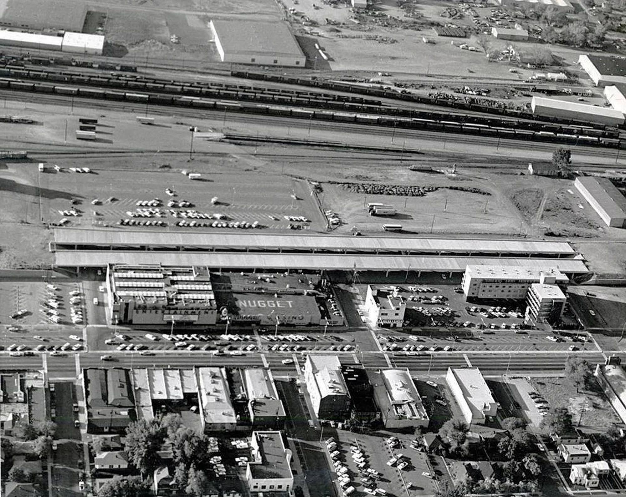
Source Caption: Interesting aerial photograph of the Nugget and downtown Sparks in the late 1960's during the construction of Interstate 80. The Nugget would later expand and construct a portion of its casino underneath the freeway.


Post A Comment