← Previous Photo
Virginia & Truckee #22
Next Photo →
Cal Neva Biltmore Hotel

Sparks Aerial

Date of photo: 1995
Photographer: Unknown

Source: Facebook: Sparks Museum & Cultural Center

Tags: aerial, sparks,

Available Sizes: 800x551 | 1024x706 | 2048x1413

Description

An aerial photo of the Sparks Industrial district, south of the freeway and train tracks along Greg Street. Downtown Sparks and Reno are in the distance.

Actions

⇓ Download This Photo

To download this photo, choose a size below, then right-click and select "Save As".

200x137 | 250x172 | 500x344 | 800x551 | 1024x706 | 2048x1413

⇓ Embed This Photo

To embed this photo in a blog or web page, choose a size below, then copy and paste the HTML or wiki code from the box.

200x137 | 250x172 | 500x344 | 800x551

HTML code

Wiki markup

Other Data

Date Uploaded: January 9, 2022

Permanent Link: http://wnhpc.com/details/fb10159162657836715

Contributor: Sparks Museum & Cultural Center on Facebook

Source: Facebook: Sparks Museum & Cultural Center

Source URL: https://www.facebook.com/SparksMuseum/posts/10159162657896715

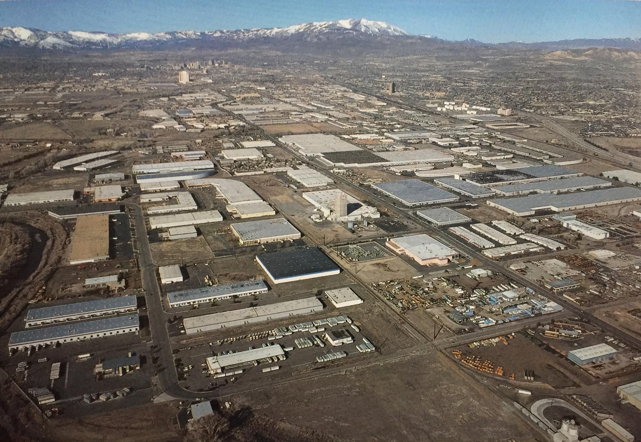
Source Caption: The Sparks industrial area is seen in this aerial photo that was around 1995. The area was largely developed in the 1960's and 1970's as companies and new industry moved to the area to take advantage of Nevada's free port laws and low tax structure for warehousing and distribution.


Post A Comment