Date Uploaded: June 2, 2020
Permanent Link: http://wnhpc.com/details/fb10157637917366715
Contributor: Sparks Museum & Cultural Center on Facebook
Source: Facebook: Sparks Museum & Cultural Center
Source URL: https://www.facebook.com/SparksMuseum/photos/a.208354381714/10157637917366715/?type=3&theater
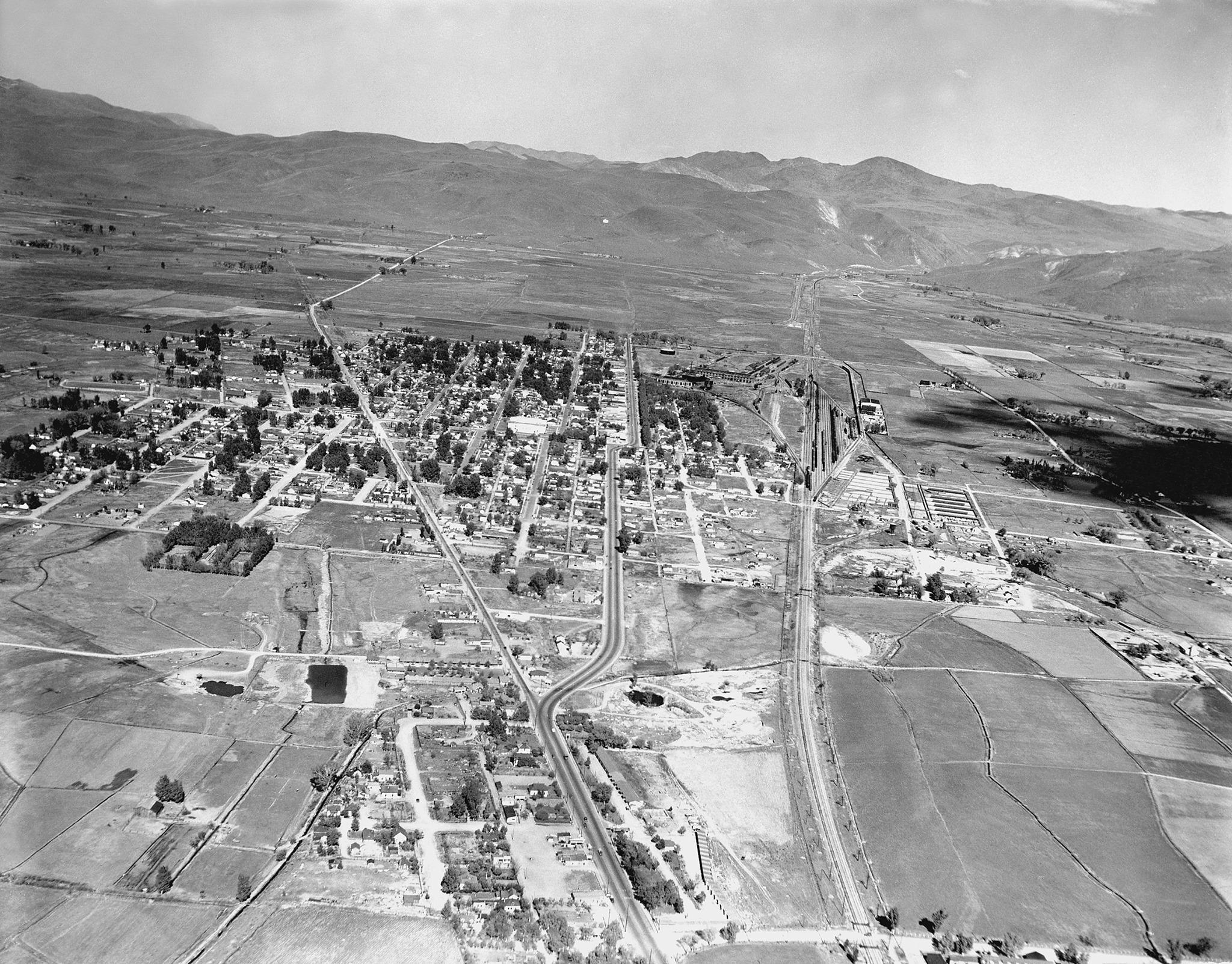
Source Caption: This aerial photograph of Sparks was in taken in the 1930's looking east. Farms on the southeast side in the Glendale District belonged to the Mapes, Kleppe, Jones, Raffetto, and Garaventa families. The photograph shows the "Y" between the old County Road (Prater Way) and B Street (Victorian Avenue). County Road was the main street leading into Sparks and was the original route of the Central Pacific Railroad. The Sparks City Council changes the name of County Road to Prater Way in 1939. The Sparks Grammar and High School and the new Robert Mitchell Elementary School were located on County Road. (Credit Joyce M. Cox Images of Sparks, NV)
Download Photo: JPG (1124 KB)
← Previous Photo
Next Photo →