Map of Nevada and California

Tags: map

Date of photo: 1881

Photographer: H.H. Hardesty and Co

Source : Library of Congress

Available Sizes: 811x1024 | 1622x2048 | 5928x7482

Download: JPG (11027 KB)

Description

An 1881 map of Nevada and California from an atlas published by H.H. Hardesty & Co out of Chicago. A closeup shows the V&T Railroad running from Virginia City to Reno, Genoa equally as important as Reno, and "Lake Bigler or Tahoe", as the name of the lake had not been officially decided yet.

Other Data

Date Uploaded: December 18, 2016

Permanent Link: http://wnhpc.com/details/ca0001391

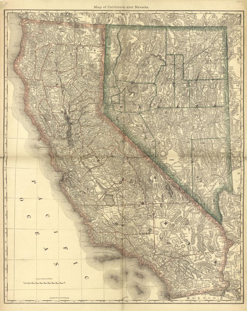
Source: Library of Congress

Source URL: https://www.loc.gov/resource/g3700m.gla00129/?sp=139

Download Photo: JPG (11027 KB)

← Previous Photo

Minden Inn

Next Photo →

Century Theaters