
← Previous Photo | Next Photo → |
Downtown Reno Rails
Date of photo: Early 1870s
Photographer: Unknown
Source: The Silver Short Line

Description
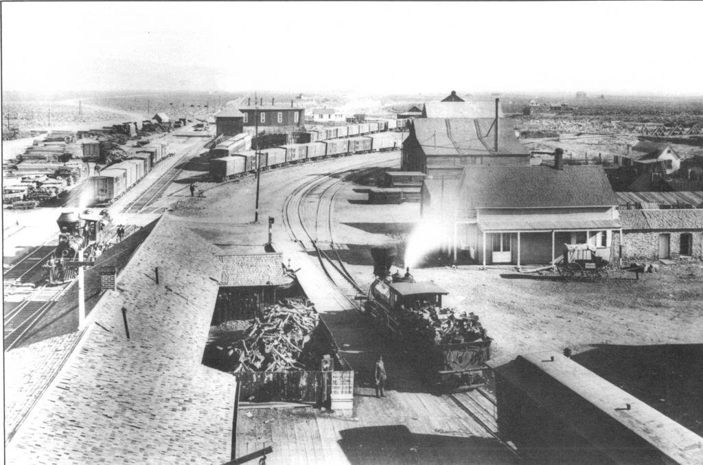
This is an overhead view of the downtown Reno train yards in the early 1870s. The Central Pacific mainline is on the left, and the Virginia and Truckee tracks are on the right. The CP tracks stretch off into the Nevada desert, as part of the Transcontinental Railroad. The V&T tracks curve to the right, where they cross the Truckee River on the truss bridge you can see in the background on the far right. Beyond that the tracks go to Carson City and Virginia City.
Actions
⇓ Download This Photo
⇓ Embed This Photo
Other Data
Date Uploaded: March 27, 2008
Permanent Link: http://wnhpc.com/details/ssl0001
Source: The Silver Short Line
Charlie Siebenthal said:
on Saturday, April 10, 2010 at 06:55 PM
This photo was taken by Carleton Watkins in 1876 or 1877. He was standing on the roof or an upper story of the Reno depot.