
← Previous Photo | Next Photo → |
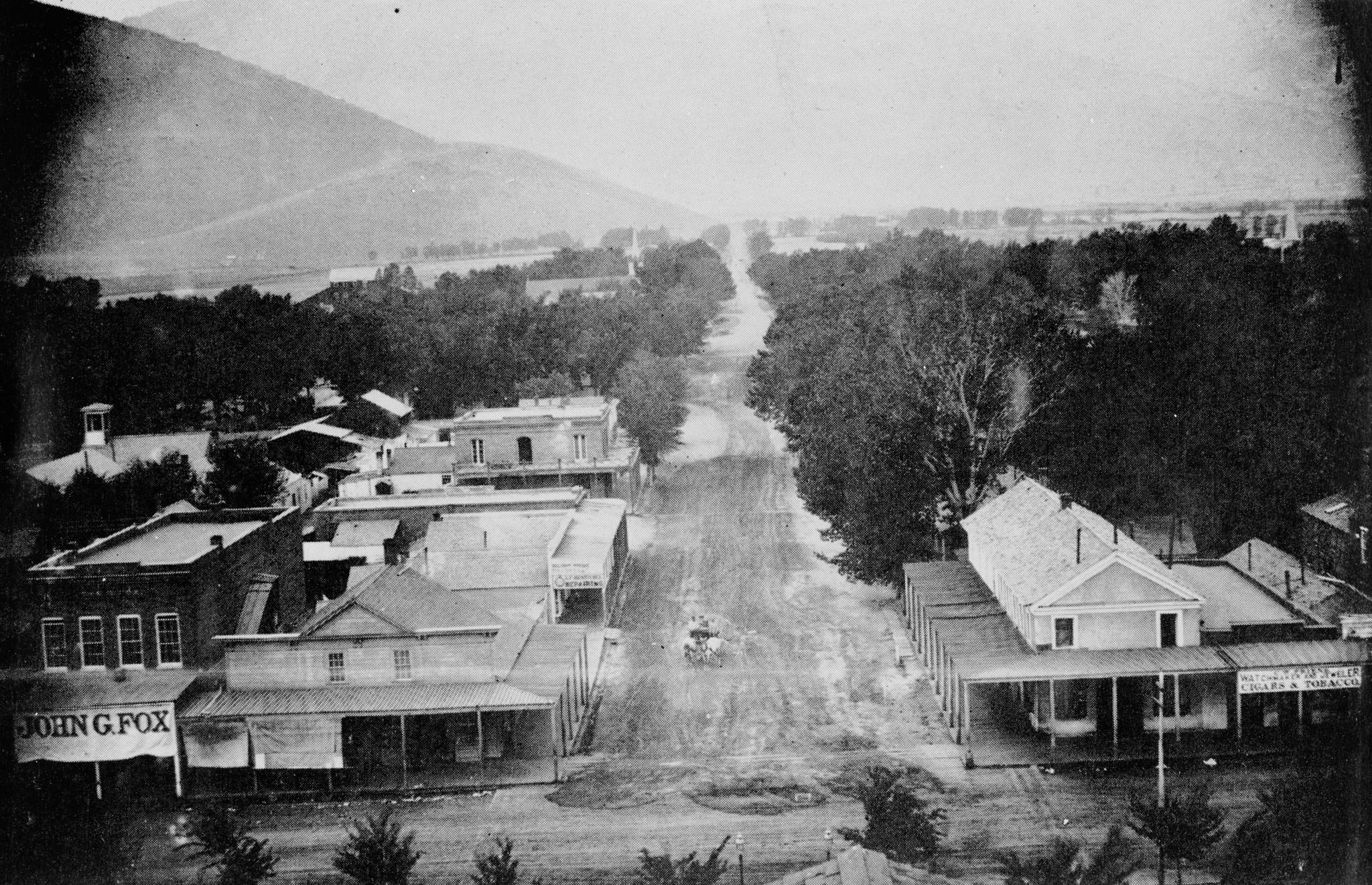
Looking West
Date of photo: Late 1800s
Photographer: Unknown
Source: Historic American Buildings Survey (Library of Congress)

Description
This view from the dome of the Nevada State Capitol looks west on King Street, towards the Sierra Nevada. At this time King was continuous all the way to Carson Street; in the 1930s the Supreme Court Building was built, closing off that first block between Carson and Curry. All of the other buildings to the left and right of King Street had already been demolished in the 1920s for the construction of two other large government buildings. At the corner of Curry, on the left, you can see the Sweeney Building, which still stands at that corner. King Street disappears into the hazy distance; at this time Kings Canyon Road was still the most heavily-used route to get from Carson City to Lake Tahoe.
Actions
Other Data
Date Uploaded: May 8, 2009
Permanent Link: http://wnhpc.com/details/photo0099
Source: Historic American Buildings Survey (Library of Congress)
Source URL: https://www.loc.gov/item/nv0049/
Source Caption: Historic American Buildings Survey, Nevada Department of Highways LOOKING WEST ON KING STREET - King Street, General View, 1880, Carson City, Carson City, NV Photos from Survey HABS NV-13-20
Post A Comment