
← Previous Photo | Next Photo → |
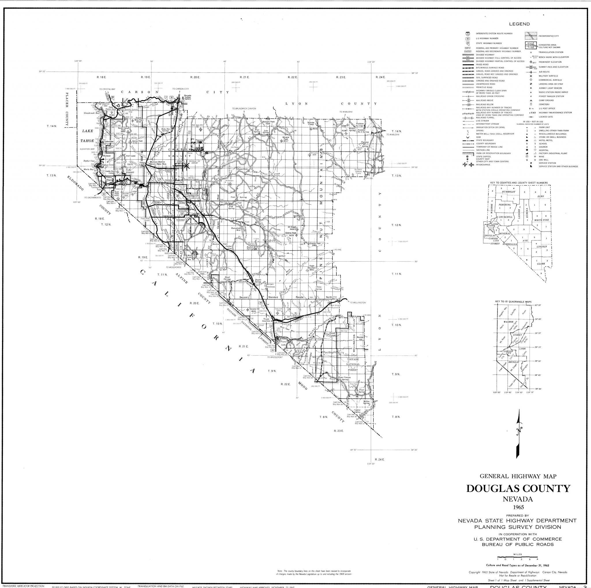
Douglas County Map 1965
Date of photo: 1965
Photographer: Unknown
Source: Historic Highway Maps: W.M Keck Earth Sciences & Mining Research, UNR
Description
Highway map of Douglas County from 1965.
Actions
⇓ Download This Photo
⇓ Embed This Photo
Other Data
Date Uploaded: March 6, 2018
Permanent Link: http://wnhpc.com/details/map0013
Source: Historic Highway Maps: W.M Keck Earth Sciences & Mining Research, UNR
Source URL: http://keck.library.unr.edu/datasets/historichighway.aspx
Post A Comment