
← Previous Photo | Next Photo → |
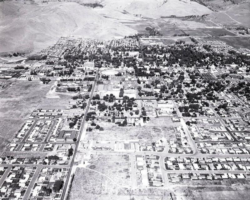
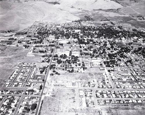
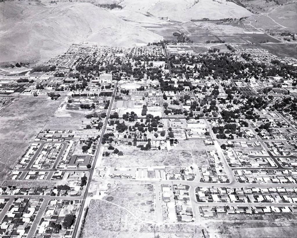
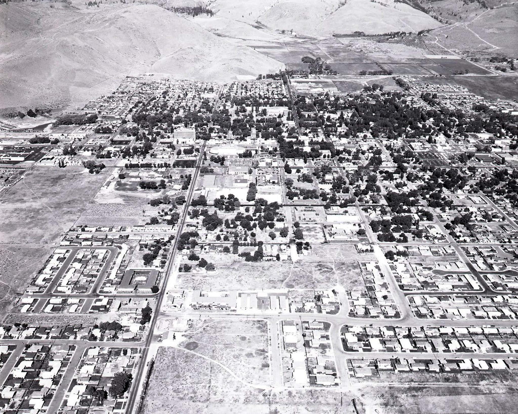
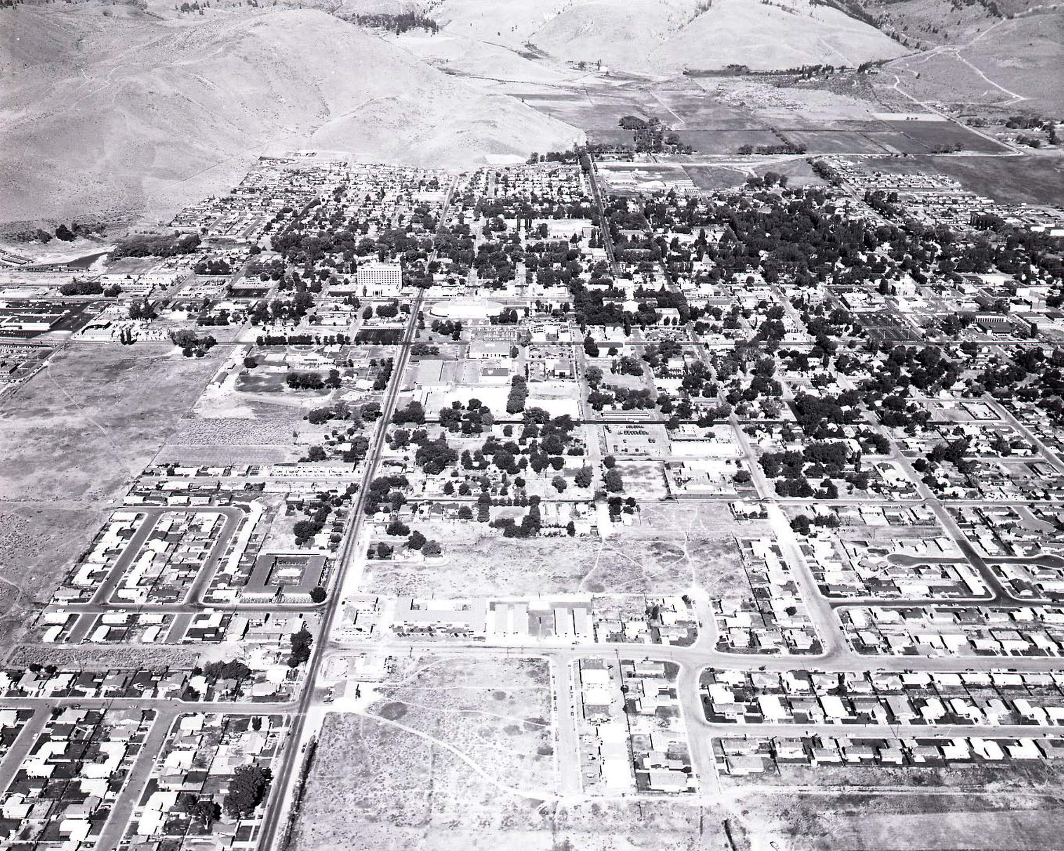
Carson City Aerial
Date of photo: 1970s
Photographer: Unknown
Source: Flickr
Description
An aerial view of Carson City. In the foreground is Fifth Street and the Carson Meadows subdivision, which is still being built out.
Actions
⇓ Download This Photo
⇓ Embed This Photo
Other Data
Date Uploaded: August 11, 2013
Permanent Link: http://wnhpc.com/details/flickr7791346654
Contributor: NDOT PIO (via Flickr)
Source: Flickr
Source URL: http://www.flickr.com/photos/76227869@N06/7791346654/
Post A Comment