
← Previous Photo | Next Photo → |
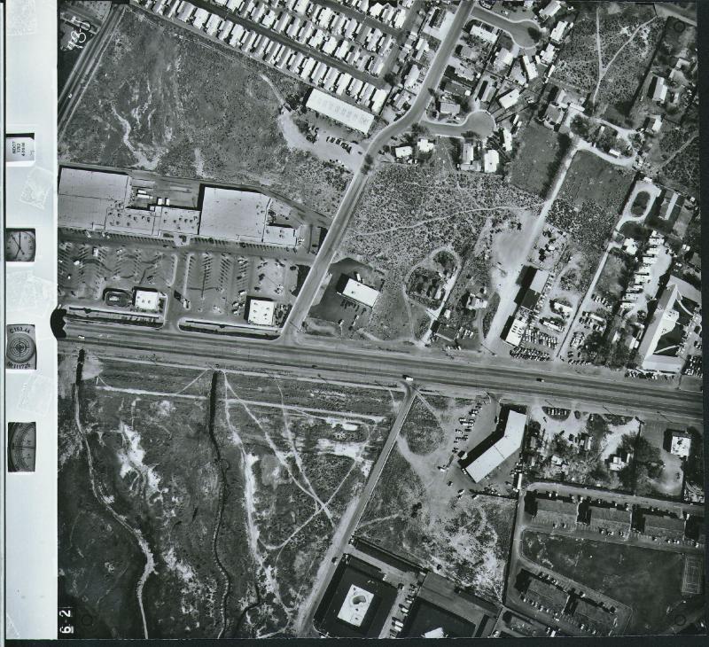
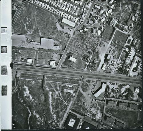
Carson City Aerial
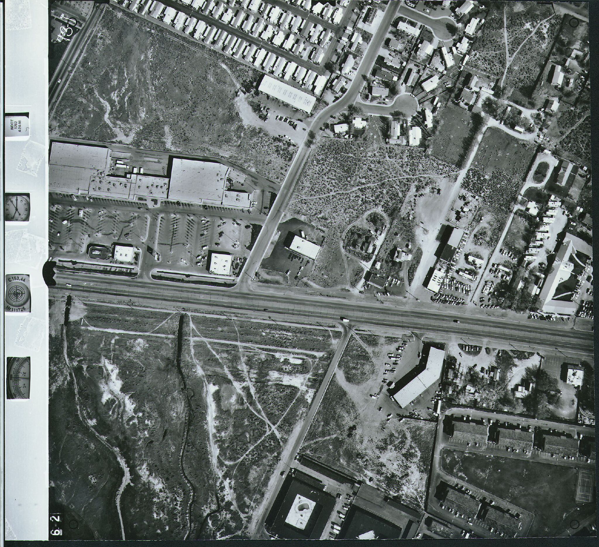
Date of photo: 1986
Photographer: Unknown
Source: Flickr
Description
A look straight down at eastern Carson City near Lompa. Lucky's and Long's are visible. The Carson City Freeway would later go through here.
Actions
⇓ Download This Photo
⇓ Embed This Photo
Other Data
Date Uploaded: July 30, 2009
Permanent Link: http://wnhpc.com/details/flickr316984281
Contributor: ScottSchrantz (via Flickr)
Source: Flickr
Source URL: http://www.flickr.com/photos/scottschrantz/316984281
View on Flickr: https://www.flickr.com/photos/scottschrantz/316984281
Post A Comment