
← Previous Photo | Next Photo → |
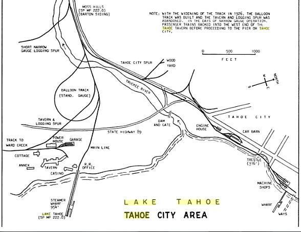
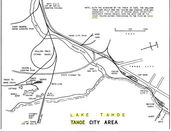
Tahoe City Railroad Map
Photographer: Unknown
Source: Facebook: Stephen Gennerich
Description
A map of the rail lines and major roads in Tahoe City, early 20th century.
Actions
⇓ Download This Photo
⇓ Embed This Photo
Other Data
Date Uploaded: August 30, 2014
Permanent Link: http://wnhpc.com/details/fb715023335237282
Contributor: Stephen Gennerich on Facebook
Source: Facebook: Stephen Gennerich
Source URL: https://www.facebook.com/photo.php?fbid=715023335237282&set=gm.277468832460894&type=1
Source Caption: This is the Lake Tahoe Railroad and Transportation Company's map of Tahoe City which shows the tracks to the Tavern and to TC
Post A Comment