
← Previous Photo | Next Photo → |
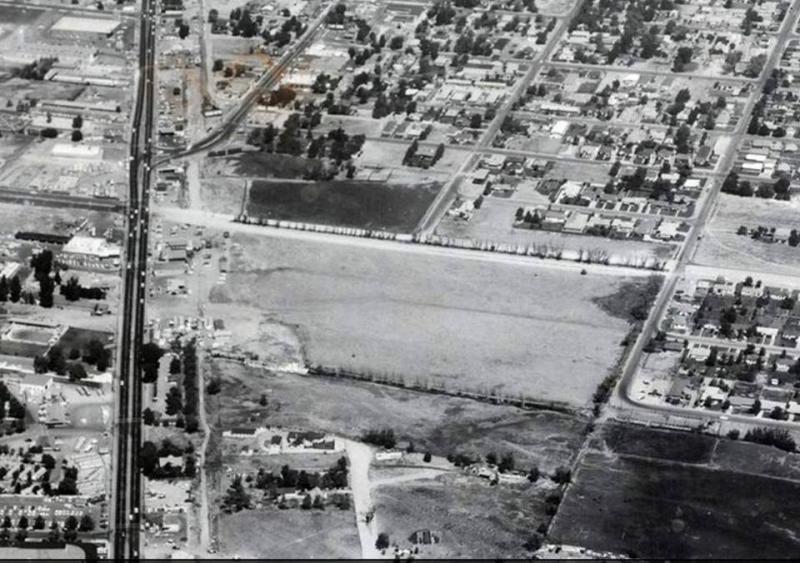
Reno Aerial
Date of photo: 1959
Photographer: Unknown
Source: Facebook: Conrad Stelzner
Available Sizes: 800x563 | 960x676
Description
A aerial view of Virginia Street in Reno, looking over the intersections with Plumb Lane and Wells Ave. The empty field at the bottom is where Park Lane Mall would later be built.
Actions
⇓ Download This Photo
⇓ Embed This Photo
Other Data
Date Uploaded: March 5, 2017
Permanent Link: http://wnhpc.com/details/fb10209400698509508
Contributor: Conrad Stelzner on Facebook
Source: Facebook: Conrad Stelzner
Source URL: https://www.facebook.com/photo.php?fbid=10209400698509508&set=pcb.10155215218745864&type=3&theater
Post A Comment